On the road with
Gypsy Louise and Me
North to Alaska – 9 Days via the Cassiar Highway
Why I Chose a Caravan for My First Canada to Alaska Drive
After a lot of research. and hearing every horror story imaginable about rough roads, long fuel gaps, and border surprises, Instead of white-knuckling my way solo from Washington State to Alaska I made a decision that felt a little out of character for me: I joined a small RV caravan led by a seasoned Alaska traveler to get me from Washington State up to Alaska.
The goal was simple: get safely from the Lower 48 to Alaska so I could begin my own independent RV travel in Alaska itinerary for the summer.
Two things pushed me there:
- I couldn’t find a travel route app (I know they are out there!) that clearly highlighted campgrounds and gas stations along the route to Alaska, and
- Despite owning The Milepost, I hadn’t yet mastered how to read and interpret it.
The plan was straightforward: arrive in Alaska by the end of May and depart in early August to avoid potential snowfall on the return south. (I cover that return trip to the Lower 48 via the Alaska Highway in a separate post.)
Note on The Milepost: Once I finally figured it out, it became an exceptional resource. I highly recommend buying it well in advance and giving yourself time to understand how it’s laid out. It
is overwhelming at first — take it one section at a time.
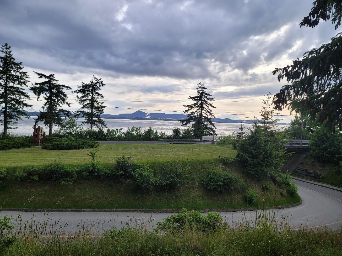
Meet-Up and Trip Prep — Bay View State Park, Mount Vernon, Washington
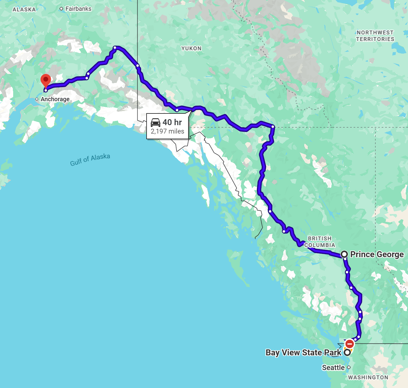
Our initial meeting point in Washington was Bay View State Park in Mount Vernon. Several of us arrived a few days early so we could enjoy the park, prep for the long haul to Alaska, and not feel rushed before crossing the Canadian border on May 20th.
Bay View State Park is a public recreation area located on Padilla Bay in Skagit County. The park spans 66 acres and includes 1,285 feet of shoreline, along with facilities for camping, picnicking, swimming, and beachcombing. Campsite fees vary depending on whether you choose tent sites, primitive sites, or partial or full hookups.
Due to a shift in my travel plans, I ended up staying at Bay View State Park for nine nights. That turned out to be perfect, as I still had work projects to wrap up before taking the entire summer off for my Alaska adventure.
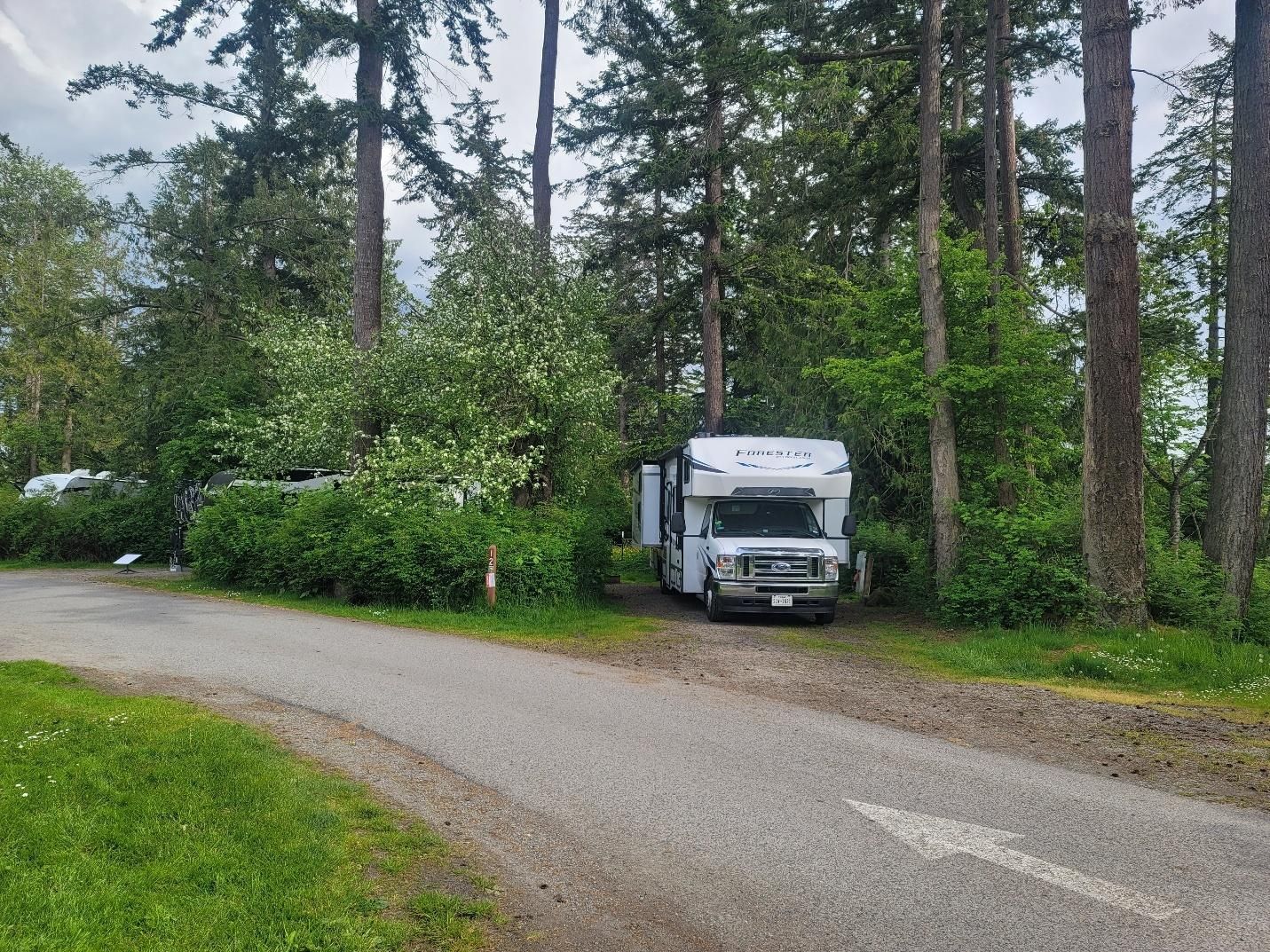
The night before departure, we gathered for introductions. The following morning brought route briefings, last-minute questions, and the group photo before pointing our rigs north.
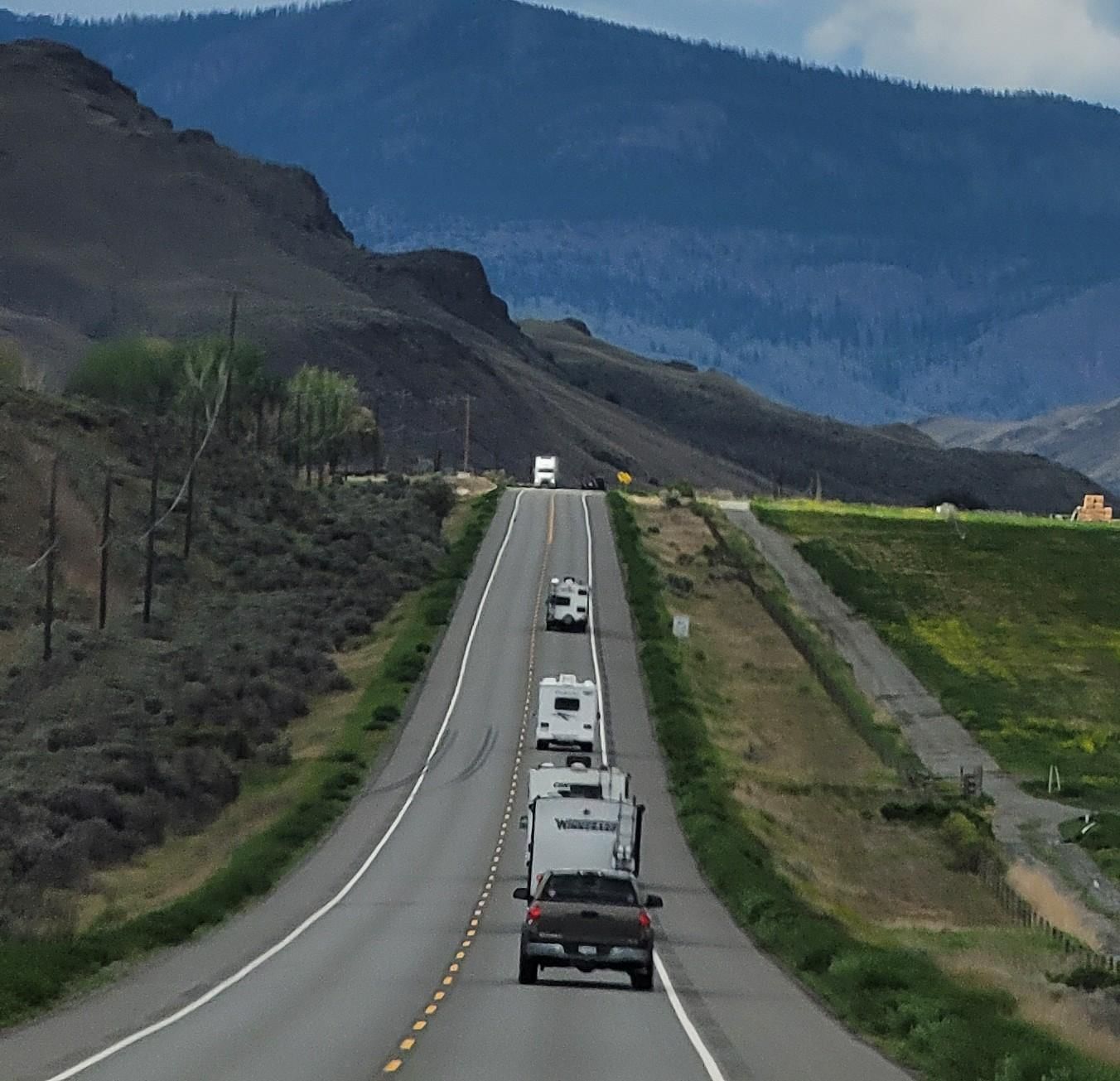
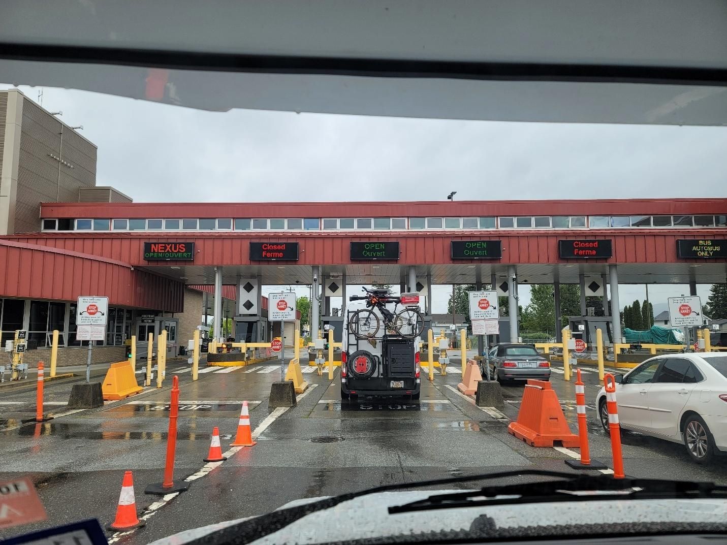
Day 1 — Crossing the Canadian Border and On to Clinton, BC
Miles driven: 320 miles
There are a few important things to know before crossing the Canadian border — how to answer questions, what to carry, and what not to carry.
Be polite. Shut off your engine at the checkpoint. And do
not use the Nexus or commercial lanes.
When answering questions, less is more:
- “Have you been to Canada before?” Yes.
- “When?” A long time ago.
- “Do you remember the dates?” No.
Guns are a hard no. Certain food items are also prohibited. In 2025, raw eggs, raw chicken, some citrus, and avocados were the big offenders. Confiscation is common, so the easiest approach is to cross with minimal fresh food. The easiest approach is to cross with minimal fresh or uncooked frozen food, whether heading into Canada or returning to the U.S.
There are several border crossings along the Washington State line. We chose Sumas, which our leader recommended as less busy.
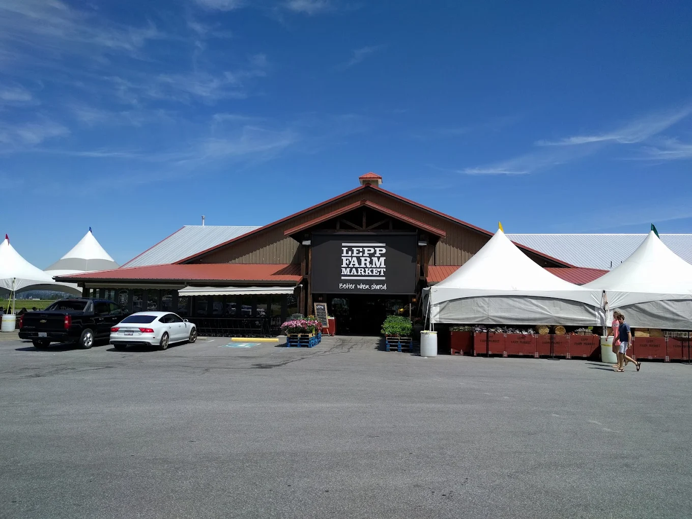
After crossing, we stopped to obtain Canadian currency, then made a slightly out-of-the-way but totally worthwhile stop at
Lepp Farm Market
in Abbotsford, BC. The produce was outstanding, and they also carry regular grocery staples. Well worth it.
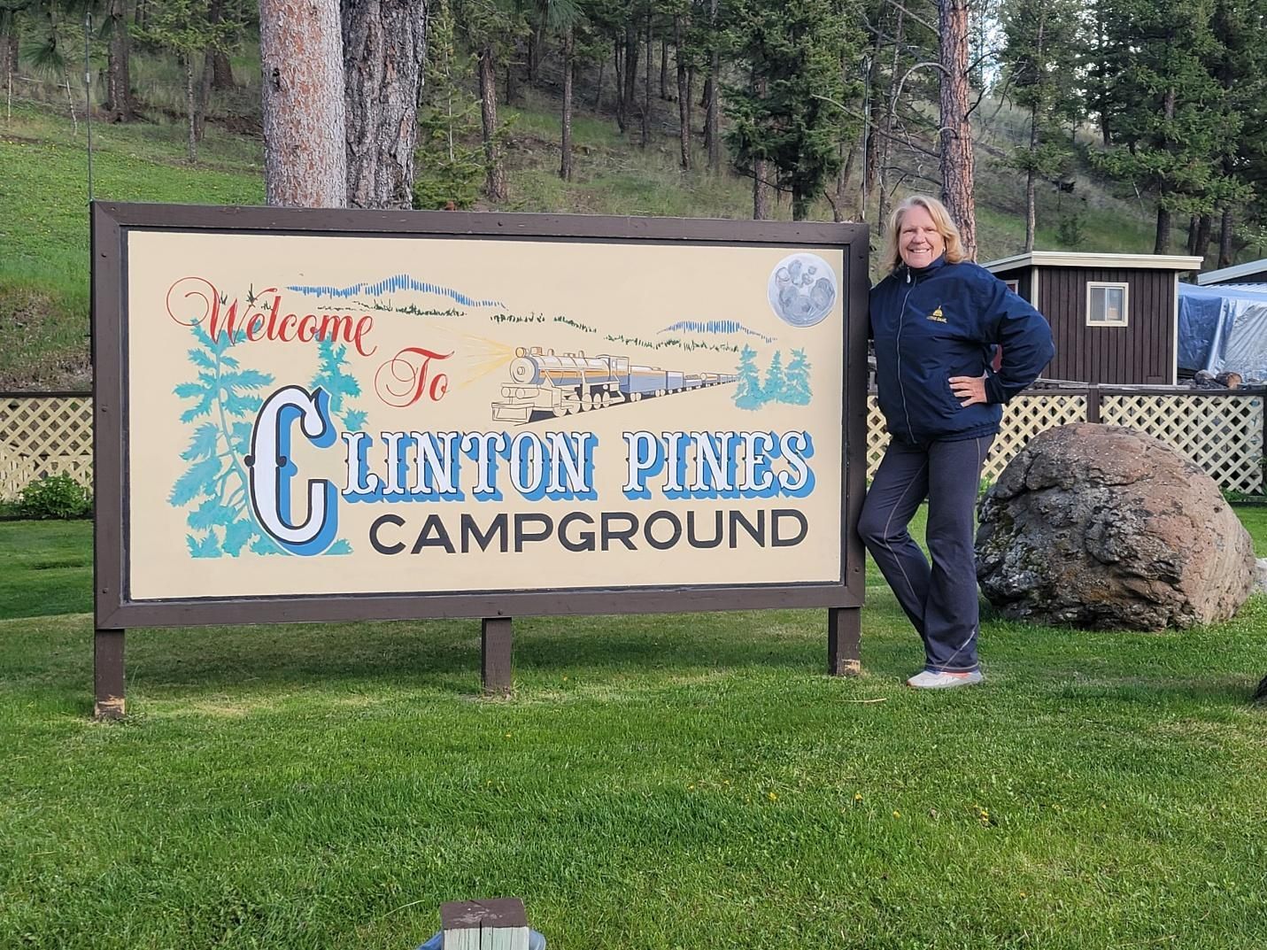
From there, we headed to our first overnight stop: Clinton Pines Campround, located just outside Clinton, British Columbia. This small, proprietor-owned park accommodates RVs of all sizes and even has a seasonal seafood food truck onsite. The owners were incredibly welcoming and helped each of us get settled. We arrived mid-to-late afternoon, and once we were set up, many of us walked into town to explore a bit.
Day 2 — Clinton to Prince George, BC
Destination: Stone Creek RV Park and Campground
Miles driven: 227 miles
Following the advice we’d all heard repeatedly, we topped off fuel before leaving Clinton and again along the way.
At about the half-way point we stopped for a lunch break and to stretch out legs at the
Williams Lake Tourism Visitors Center
Our evening’s destination was Stone Creek RV Park and Campground in Prince George, BC, another small, family-owned park. A heads-up: slow down as you approach the entrance so you don’t miss it and be aware that Google Maps may try to send you farther north to turn around. Avoid that. Check their website for current details and reservation info.
Campsites are set on grass along the river and are absolutely lovely. This park offers electric hookups only. After everyone settled into their site, we gathered together for a little “happy hour” and snacks and to get to know each other a little more.
Day 3 — Prince George and the Official Start of the Cassiar Highway
Destination: Kitwanga River RV Park
Miles driven: 323 miles
Day three took us north through
Prince George to Highway 16 where we turned west to reach Highway 37, the Cassiar Highway.
That evening we stayed at
Kitwanga River RV Park, another proprietor-owned campground tucked just off Highway 37. It’s a hidden gem in the Pacific Northwest of British Columbia, especially for families and adventure seekers, marked which marked the official start of our drive along the Cassiar Highway.
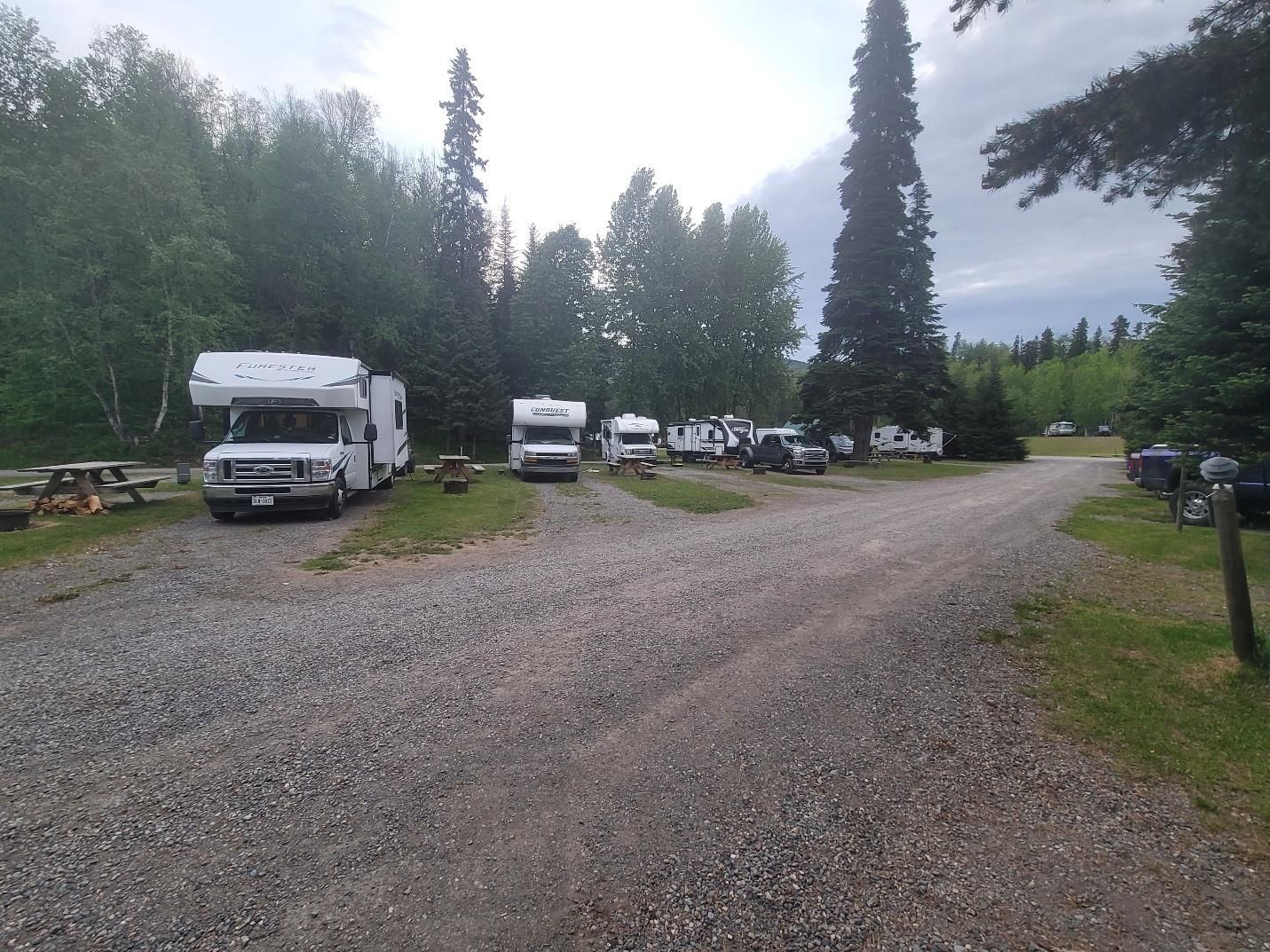
The Kitwanga River runs directly through the property and is a Class 2 river open to steelhead and salmon fishing. Being right off the Cassiar means easy access to hiking, fishing, and off-road trails.
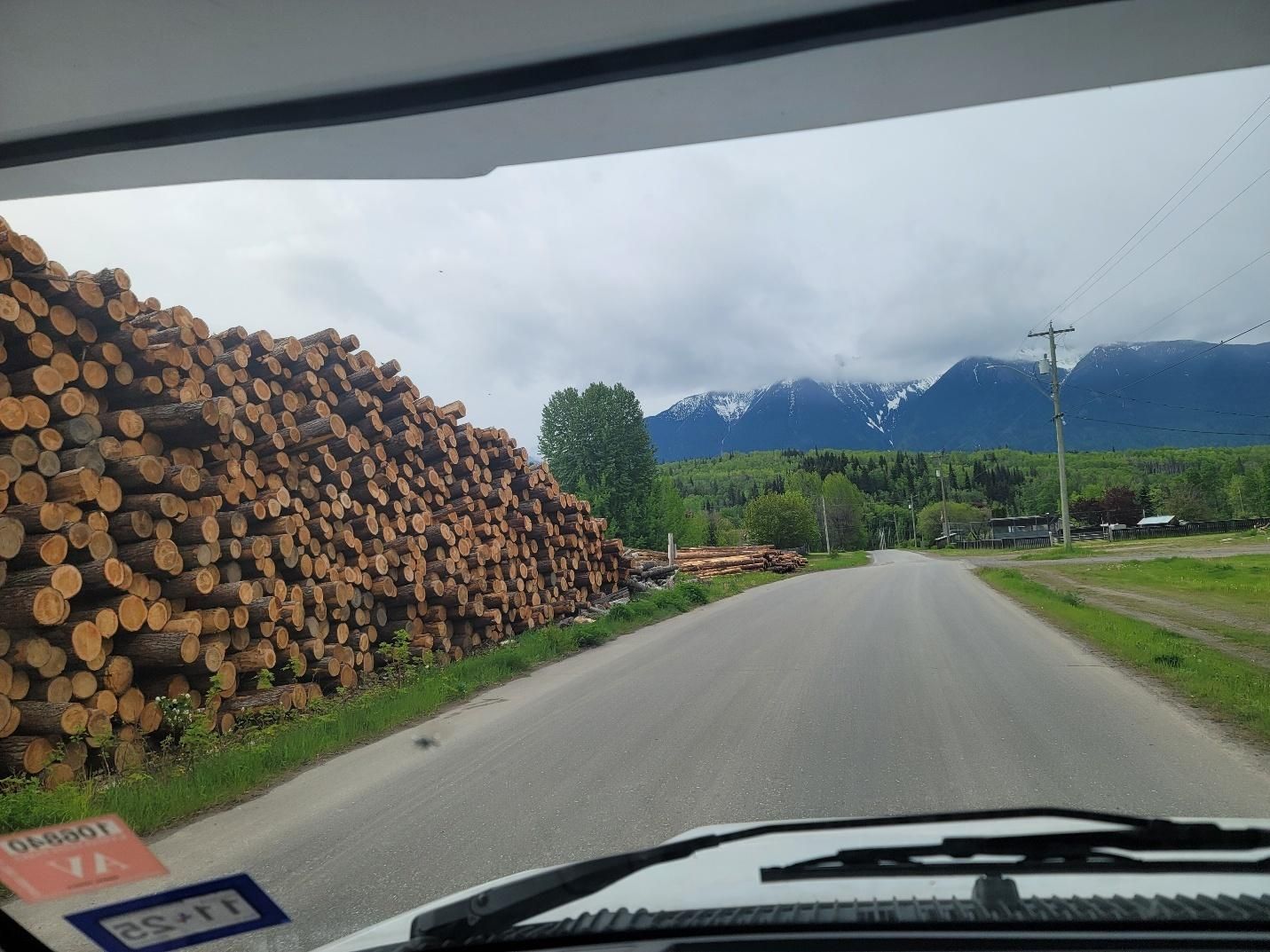
This part of British Columbia is known for its logging industry, and just outside of the park was a staging area with logs stacked over 10 feet high in rows longer than a football field.
Day 4 — Cassiar Highway to Kinaskan Lake Provincial Park
Miles driven: 220 miles
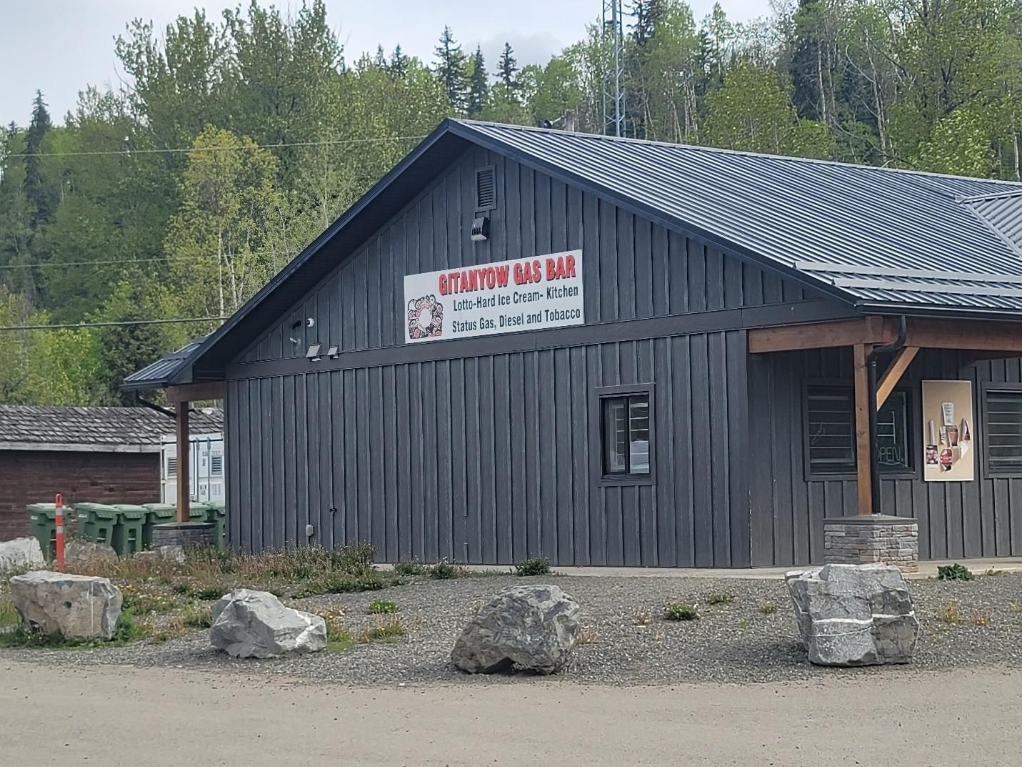
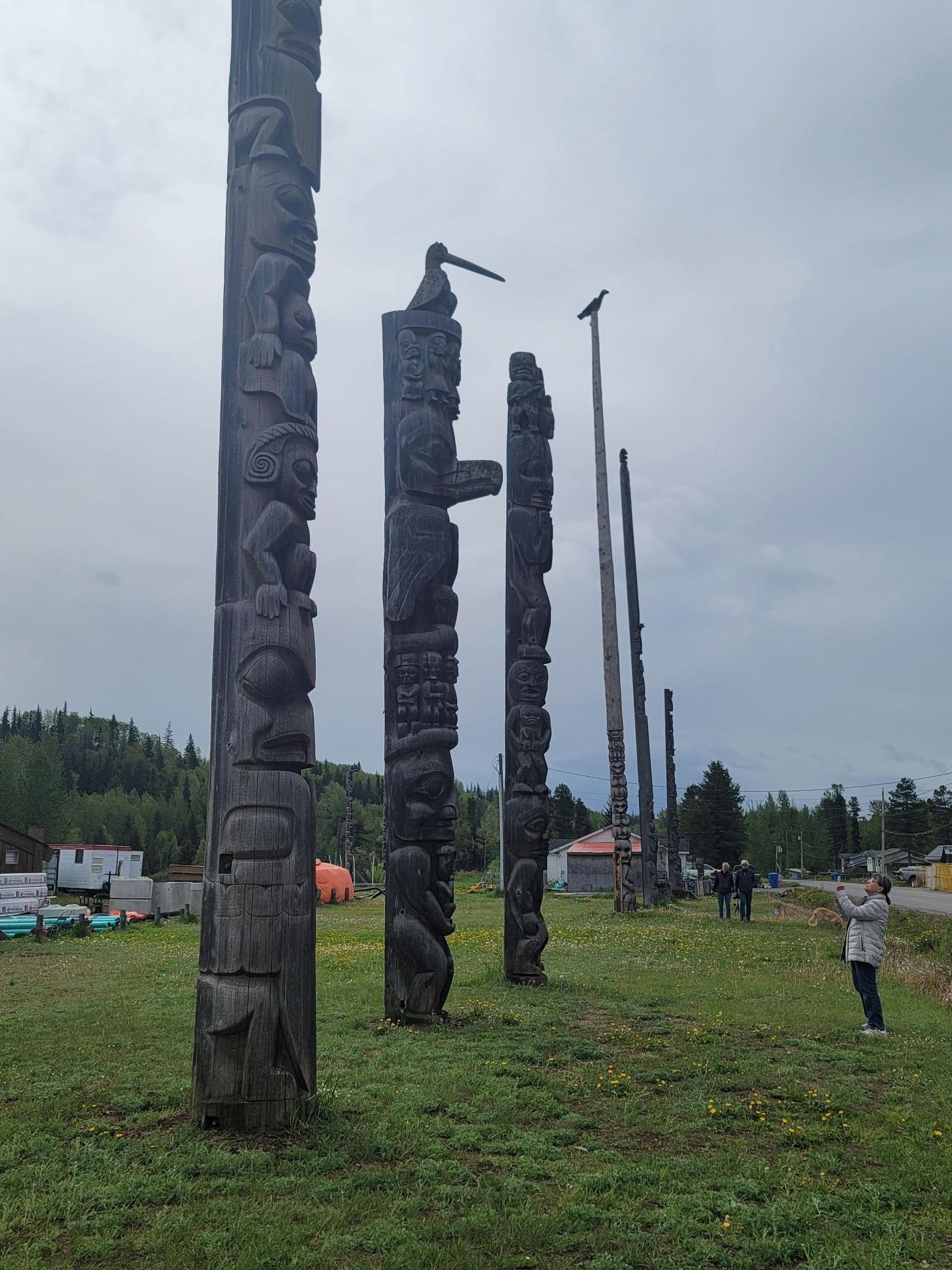
But before hitting the road, we stopped to refuel our vehicles at the
Gitanyow Gas Bar and Totem Poles. An interesting stop on native lands. There were some amazing totem poles, so we took some time to check these out before heading out on the Cassiar.
As a group, we had some miscommunications. As a result of the direction in which I was facing on the road, I went back to the Cassiar the same way I came in, (followed by all but one other in our group). The other vehicle (towing a rather large travel trailer) opted for what they thought would be a shorter route but turned out to be a road closed for construction. They ended up spending a good 30 minutes to an hour getting turned around to head back out the way we came as well. Lesson learned, sometimes what you think is a shorter route, isn’t always the best route, especially if you are a big rig!
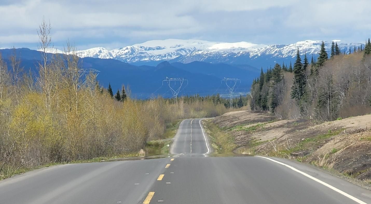
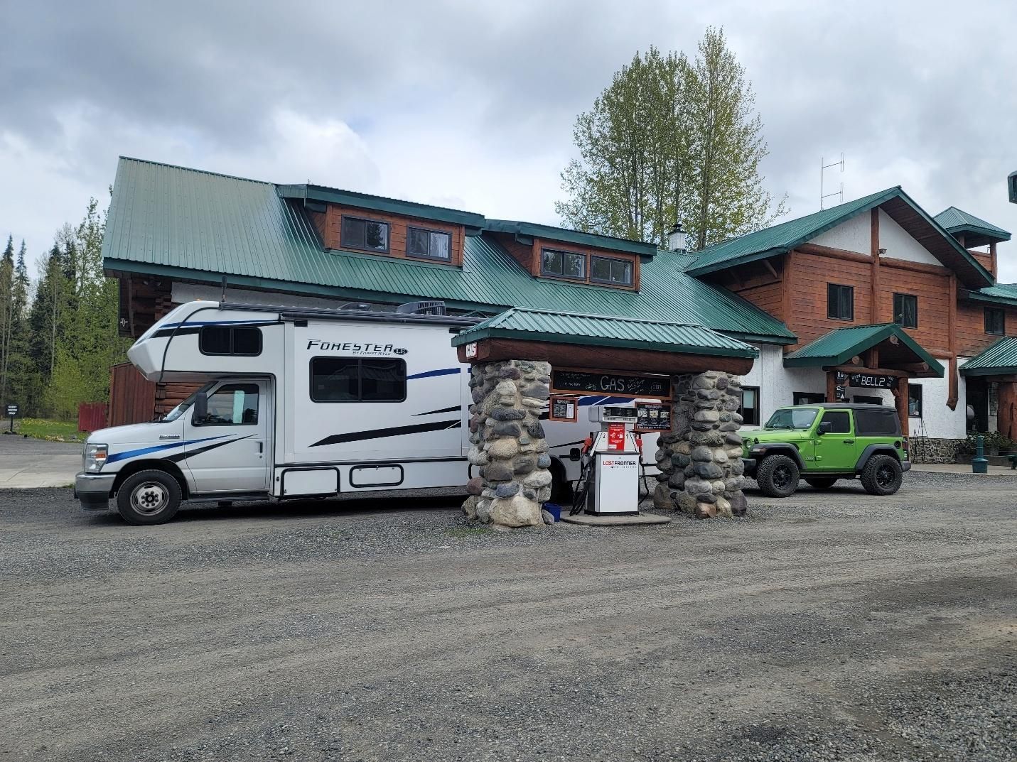
This was one of those days where the scenery never lets up with stunning views at nearly every turn. We passed through Meziadin Junction, Bell II – stopping at the
Bell II Lodge to refuel and stretch our legs , and Bob Quinn Lake—stopping for photos, fuel, and the occasional stretch break.
That night we stayed at
Kinaskan Lake Provincial Park, our first experience with
BC provincial parks. Located at the south end of Kinaskan Lake between the Skeena and Coast Mountain ranges, the campground has paved roads and gravel campsites. Despite being first-come, first-served, securing sites was easy for our group early in the season.
The fee was $20 per party per night (check the provincial park website for updates). Most sites sit right along the water, offering sweeping lake views with Todagin Mountain to the east and the Klastline Plateau to the west. The weather was cooperative, so I barely needed the generator or propane furnace.
Day 5 — Kinaskan Lake to Ta Ch’ila (Boya Lake) Provincial Park
Miles driven: 175 miles
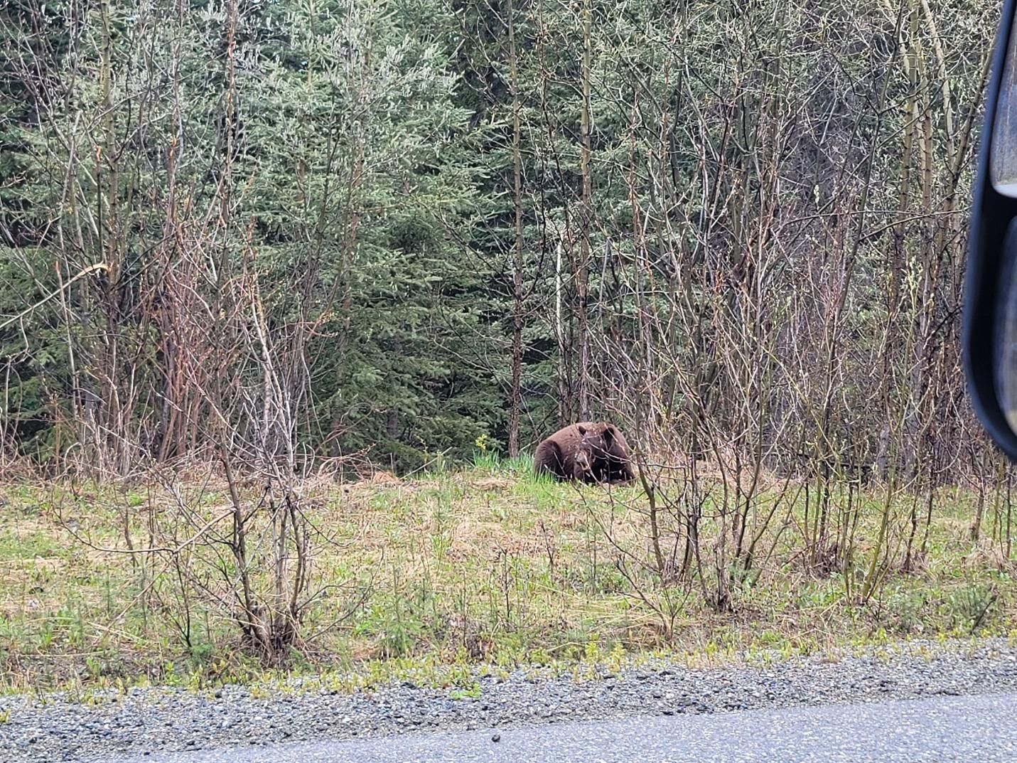
Day 5 was an easier drive, which made it feel almost leisurely by comparison. We passed through Tatogga, Iskut, 40 Mile Flats, Porter Landing, and
Jade City, and we had our first wildlife sighting! A brown bear wandering along the side of the highway.
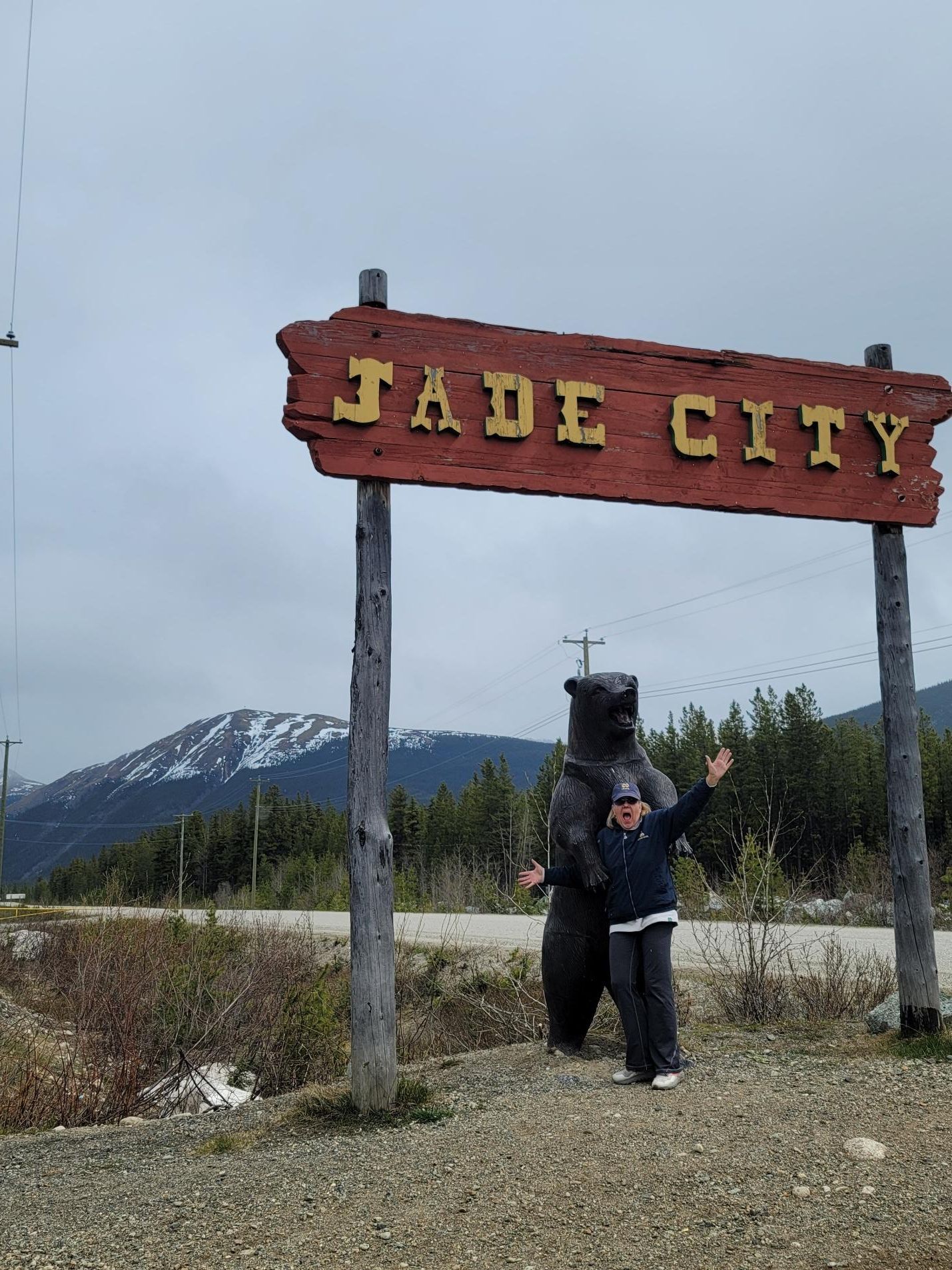
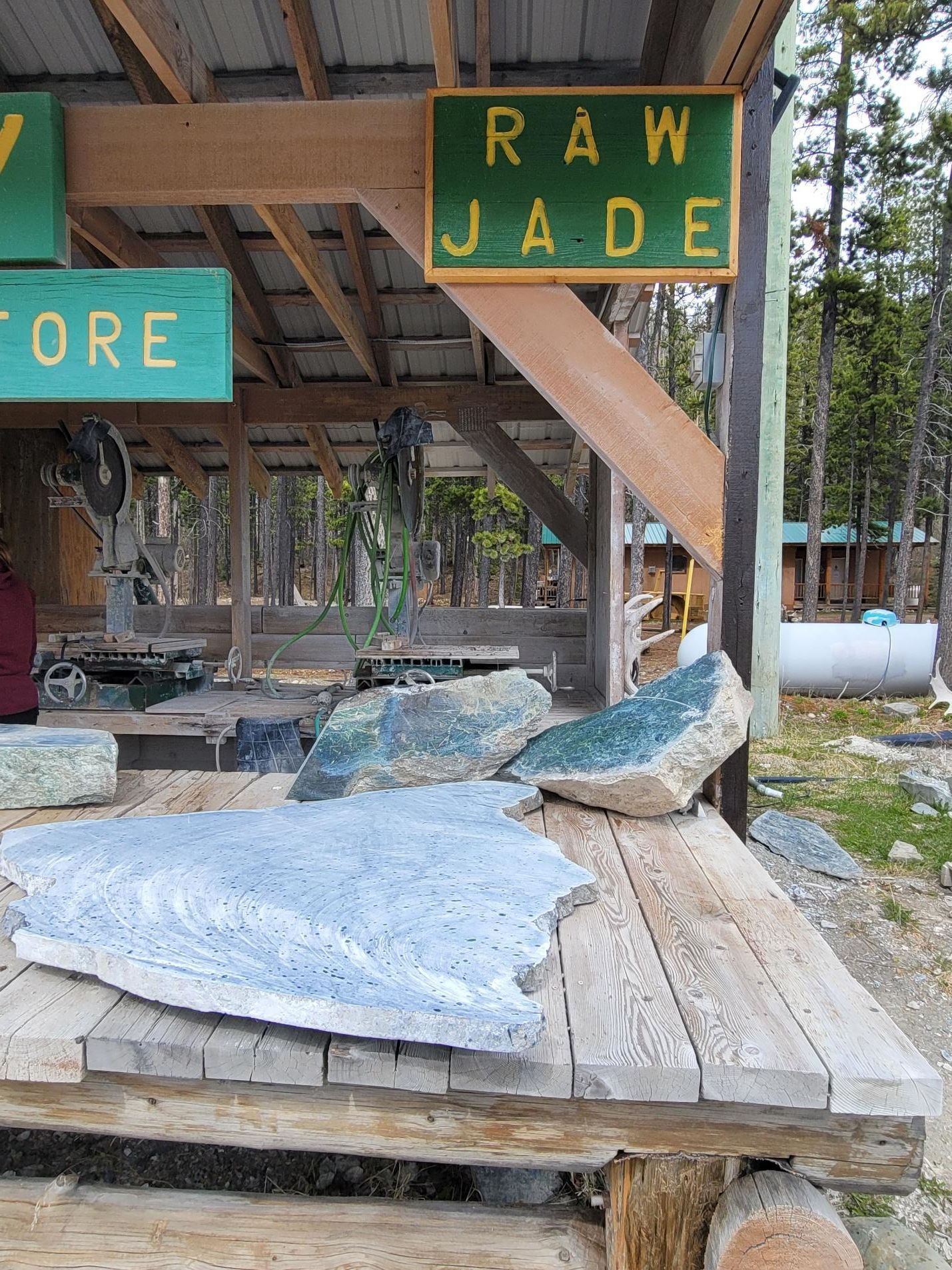
We stopped at
Jade City to explore jade jewelry and artwork made in the region and to learn more about the local jade mine. Most of us left with at least one piece — souvenirs with a story. Fun fact: Jade City offers
free overnight RV parking, including space for big rigs with toads.
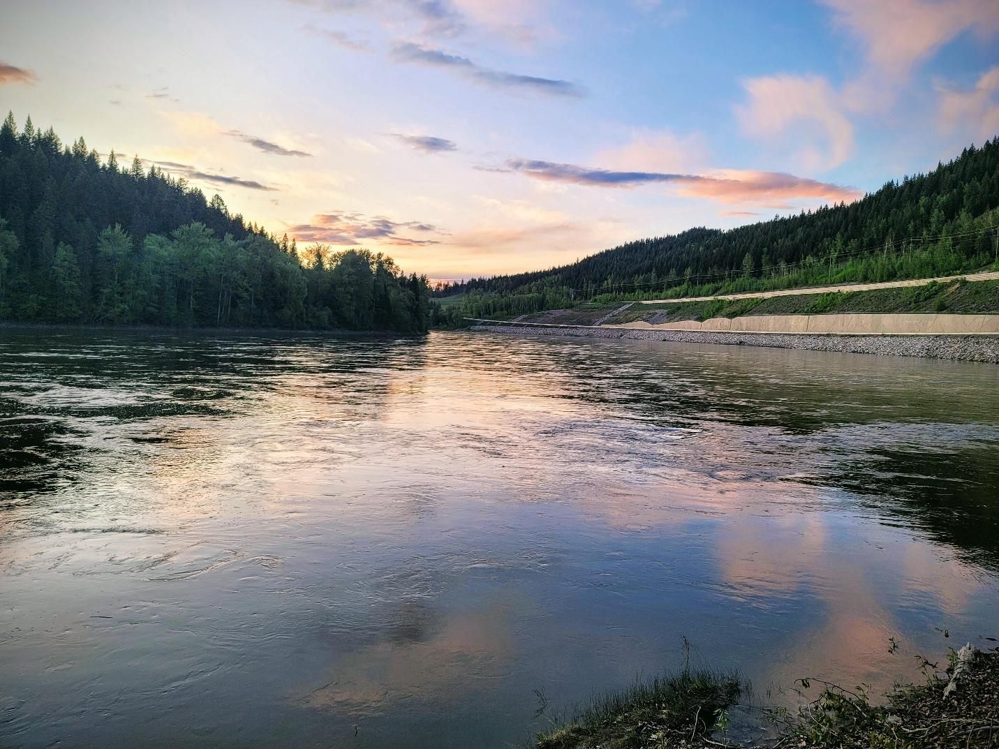
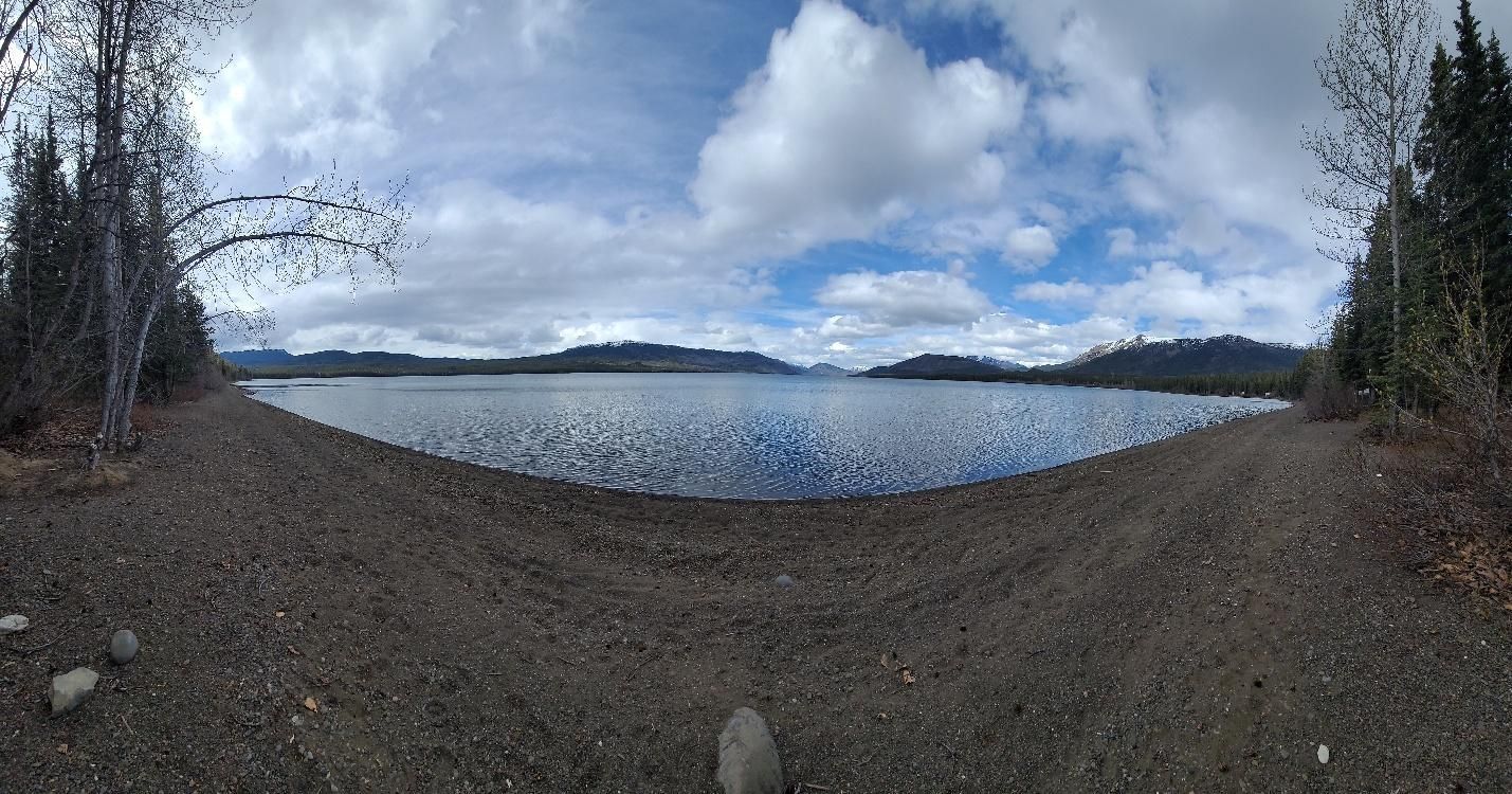
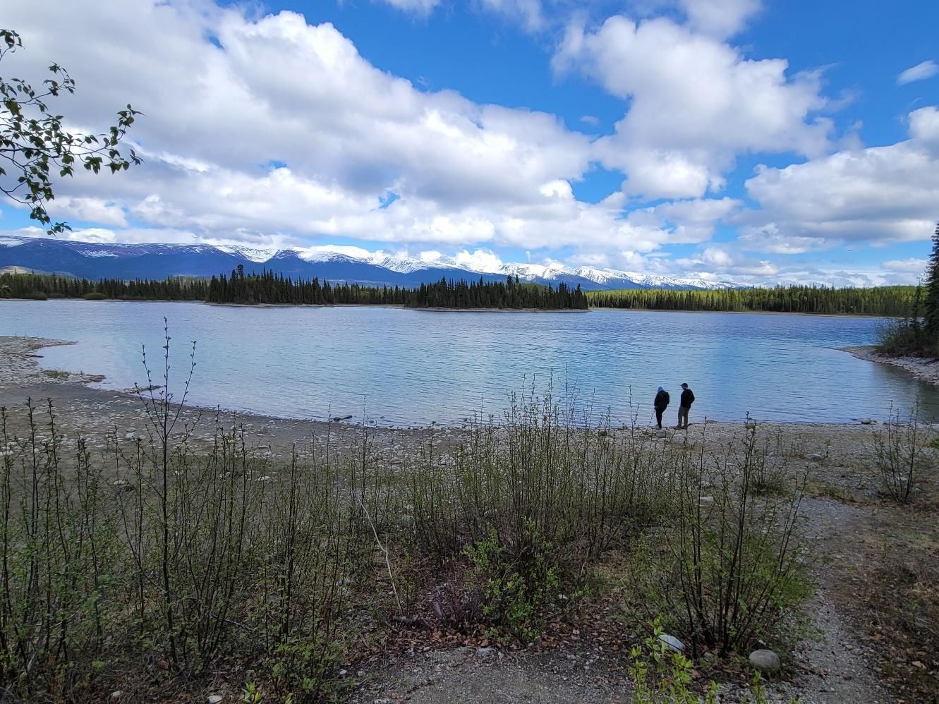
That evening we arrived at
Ta Ch’ila Park (Boya Lake Provincial Park). Reservations are strongly recommended, as this park is extremely popular. Boya Lake’s clarity and aquamarine color are unreal, and the park offers endless bays, islands, short hiking trails, and water recreation.
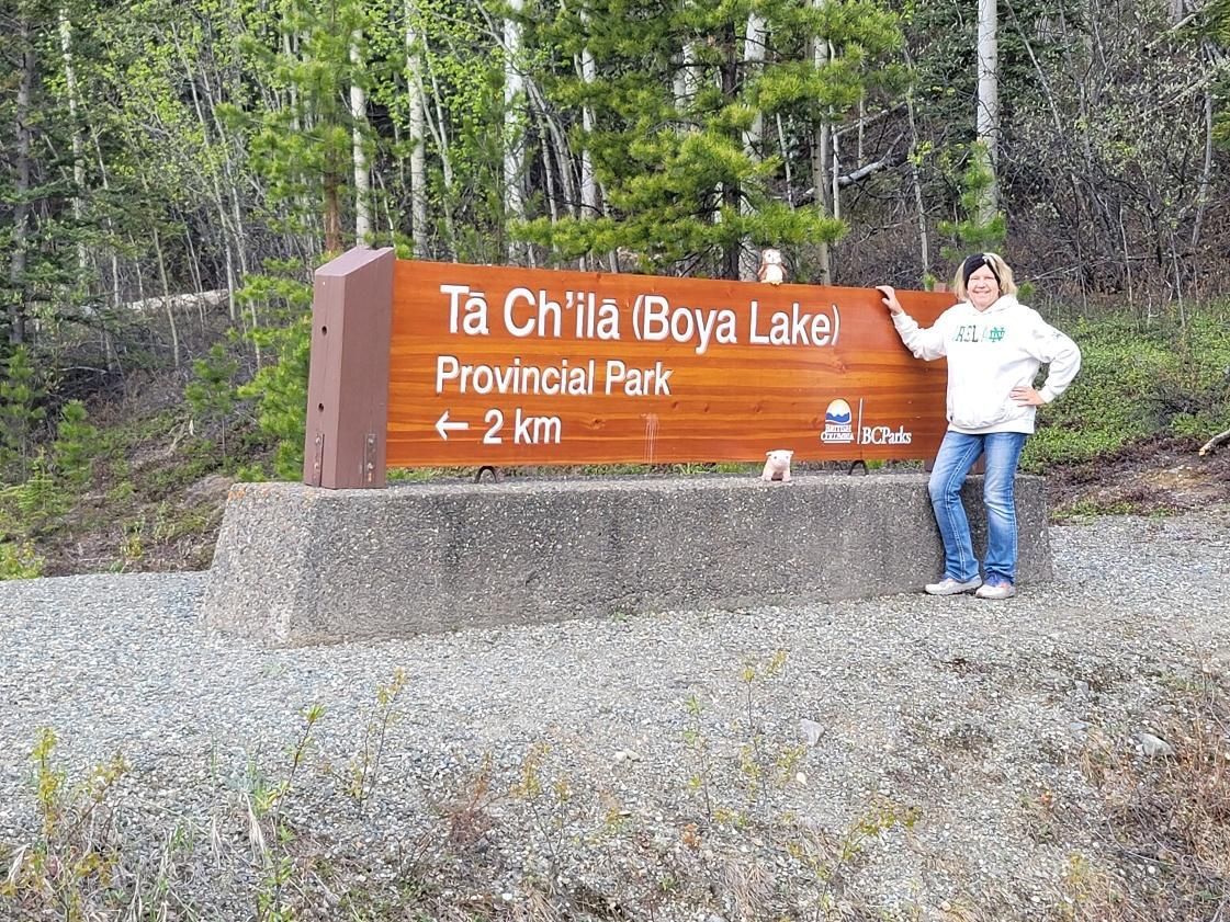
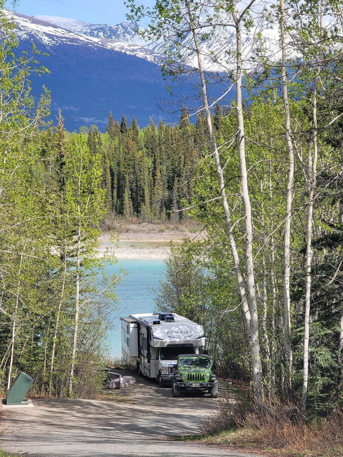
The park sits on the Liard Plain, shaped by glaciers 20,000 years ago, with long ridges (eskers) and elongated hills (drumlins). The lake’s color comes from a marl bottom — a mix of silt and shell fragments that reflect light beautifully. Boya Lake is also one of the few northern lakes warm enough for swimming.
Day 6 — Watson Lake Detour and On to Whitehorse, Yukon
Miles driven: 326 miles
Day 6 marked the end of the Cassiar Highway, where it meets the Alaska Highway just west of Watson Lake.
We detoured into
Watson Lake to visit the famous
Signpost Forest — a must-stop on any land journey to Alaska. Bring your own sign (plus nails and a hammer) if you want to leave a piece of yourself behind. Wandering through the forest and reading where everyone came from is oddly moving.
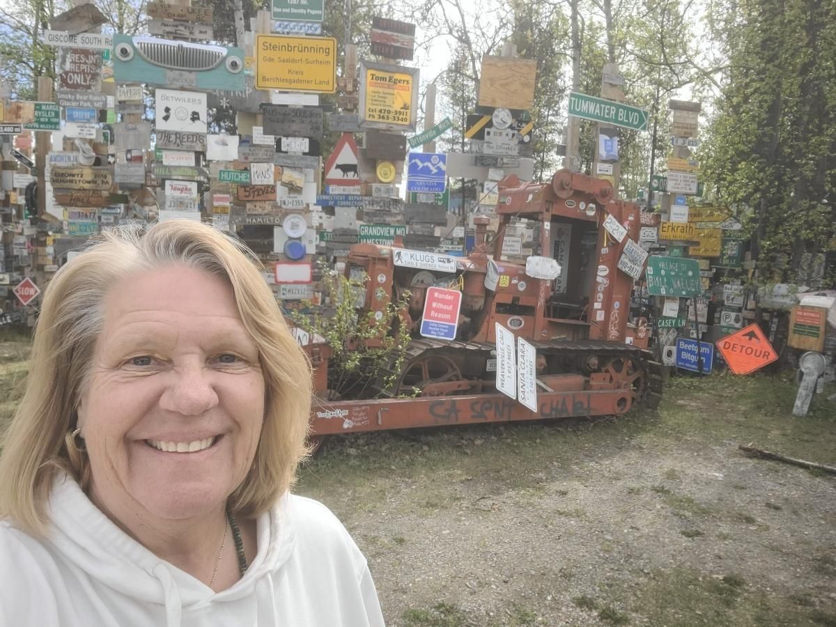
Watson Lake is also a solid place to refuel and restock groceries.
From there we continued west on the Alaska Highway, passing Rancheria and Swift River, stopping in Teslin for world-famous cinnamon buns, and refueling again before reaching
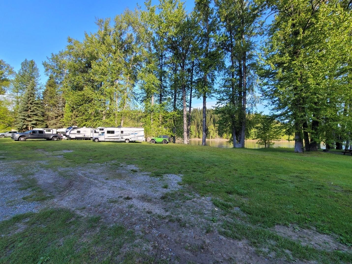
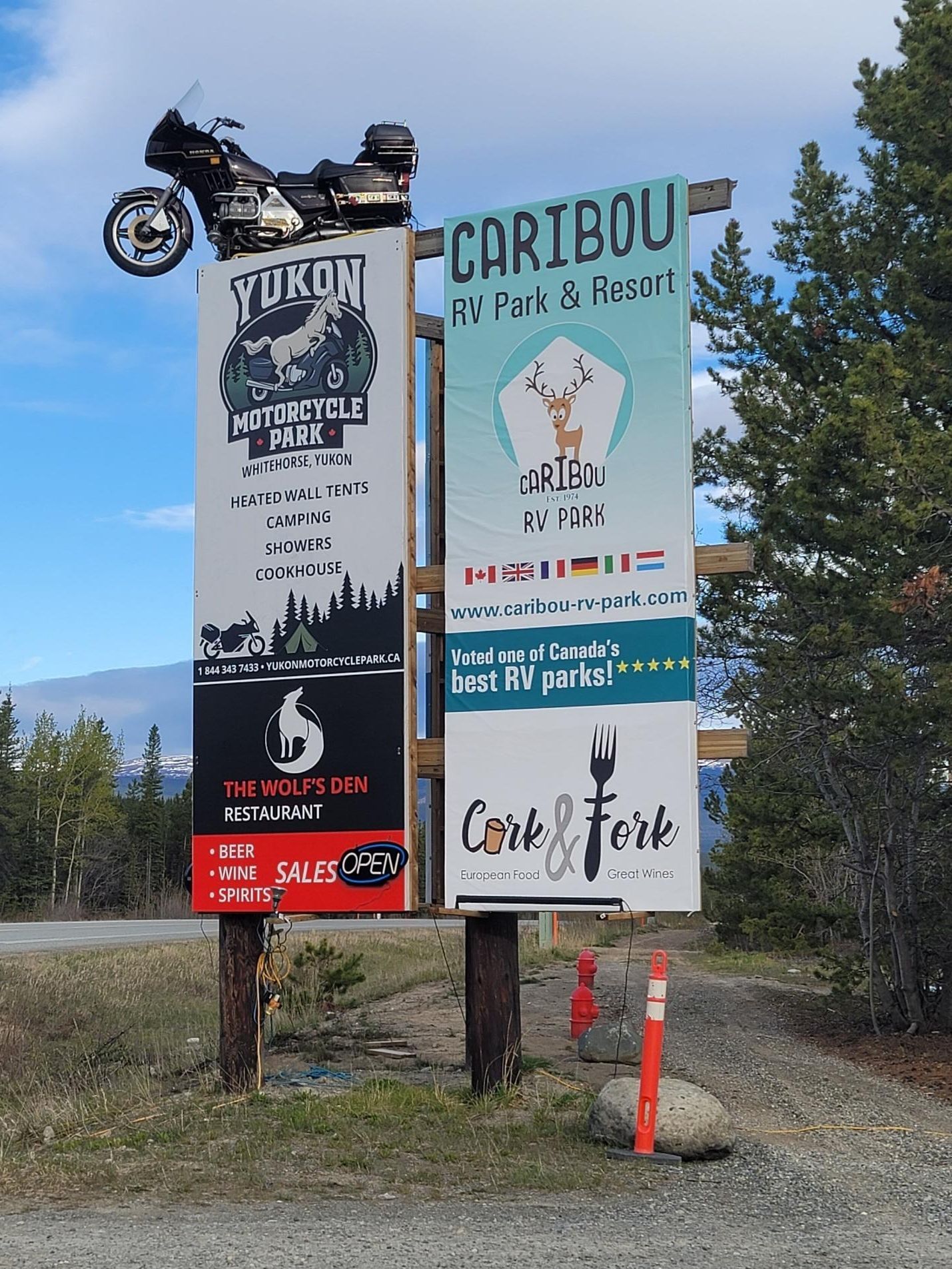
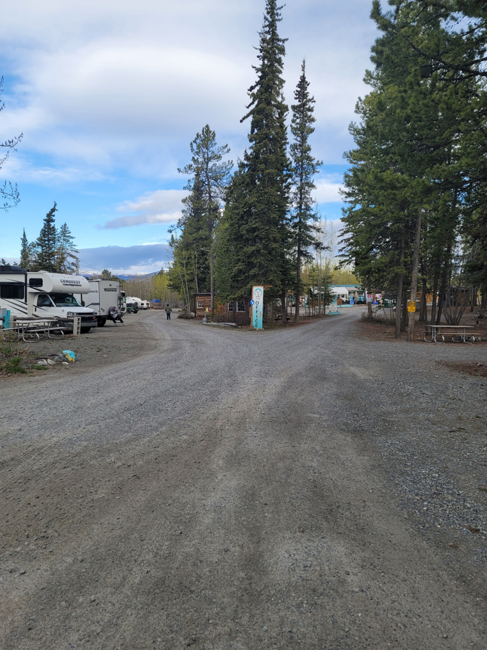
Caribou RV Park in Whitehorse, Yukon.
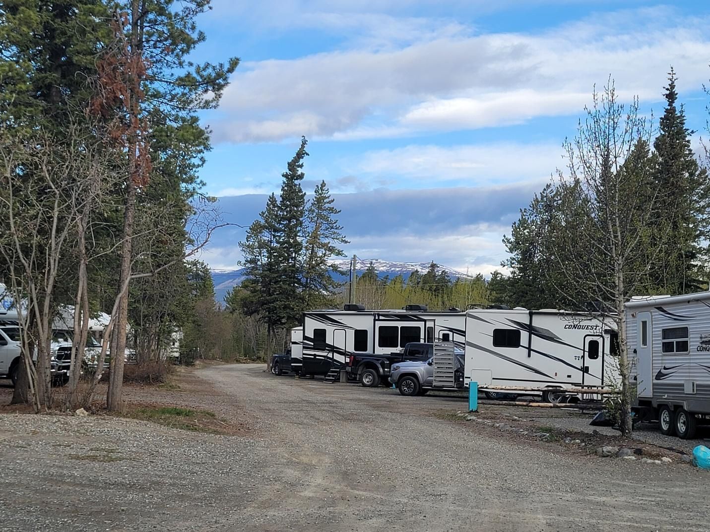
This proprietor-owned park sits near the junction of the Alaska Highway and the South Klondike Highway and offers spacious, big-rig-friendly sites with plenty of amenities. It’s an excellent base camp if you’re exploring the Whitehorse area.
Day 7 — Whitehorse to Lake Creek Campground, Yukon
Miles driven: 240 miles
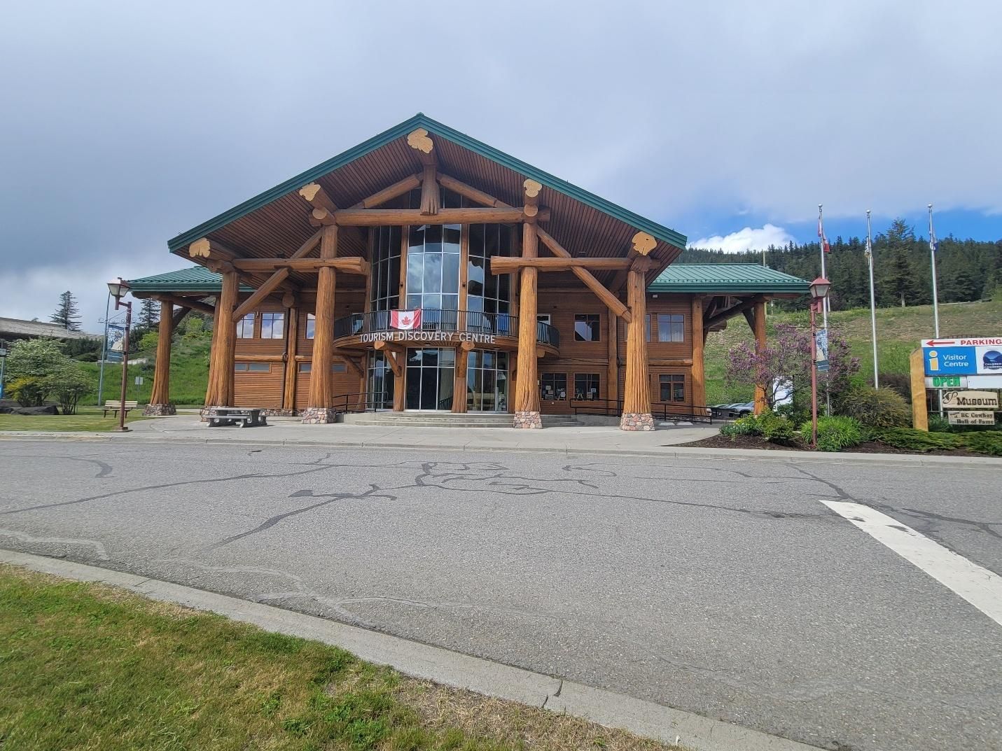
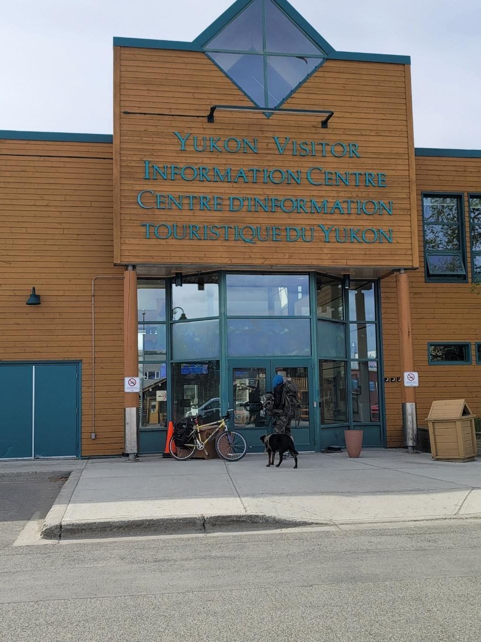
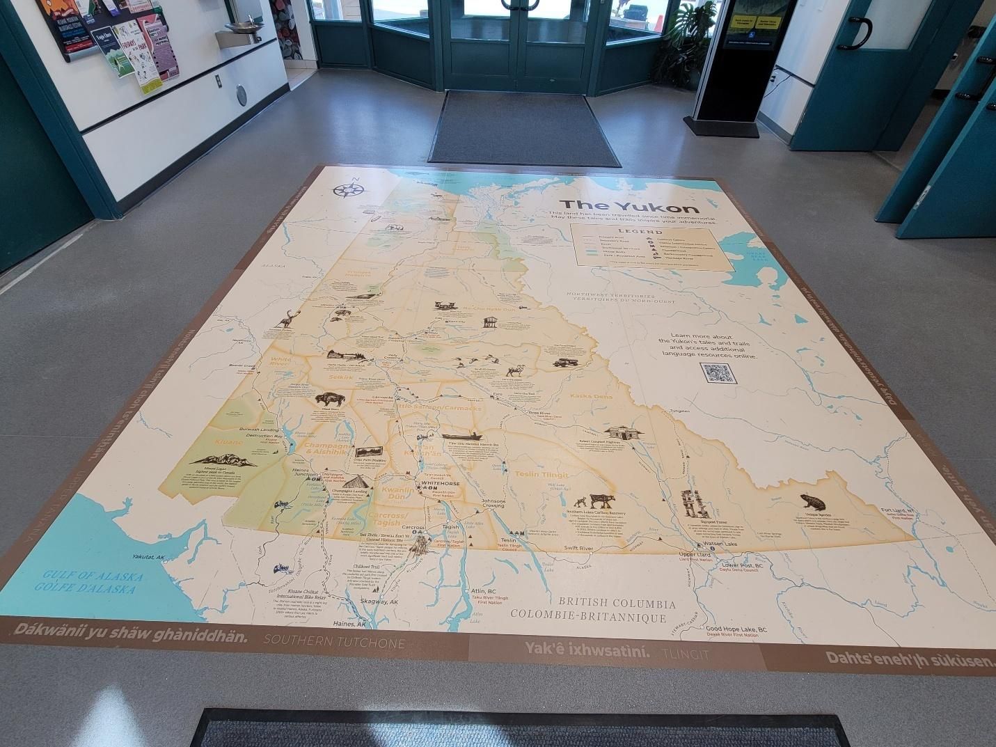
After a great night, we gathered in the morning for the day’s travel briefing. We headed out and stopped in Whitehorse visiting the
Yukon Information Visitor Centre, walking along the river, fueling up, and regrouping at a local Canadian Tire.
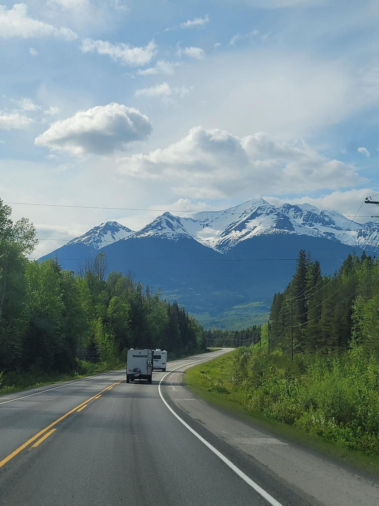
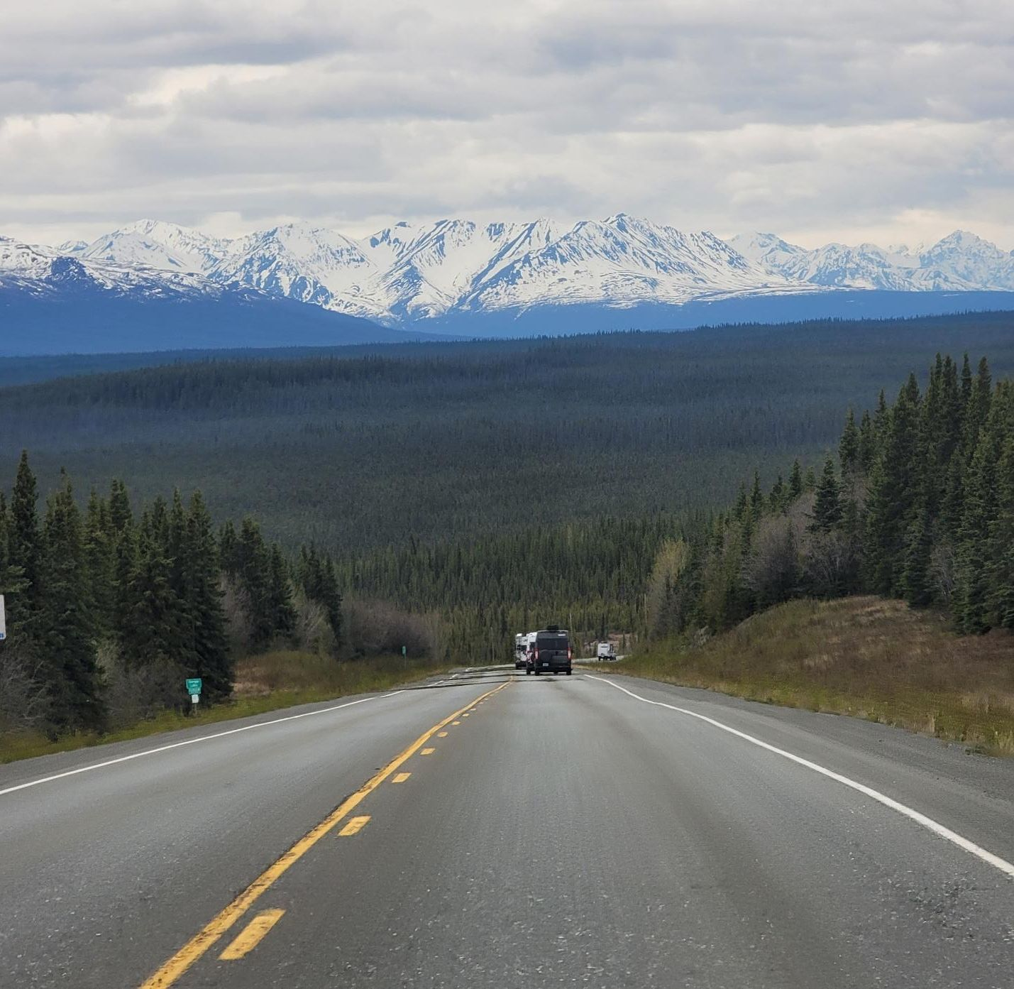
We started early, knowing this would be a slow and sometimes challenging drive through
Destruction Bay and surrounding area along the eastern edge of
Kluane National Park. Large sections of this stretch were under major construction, with long pilot-car-guided zones, so slow-going was the name of the game.
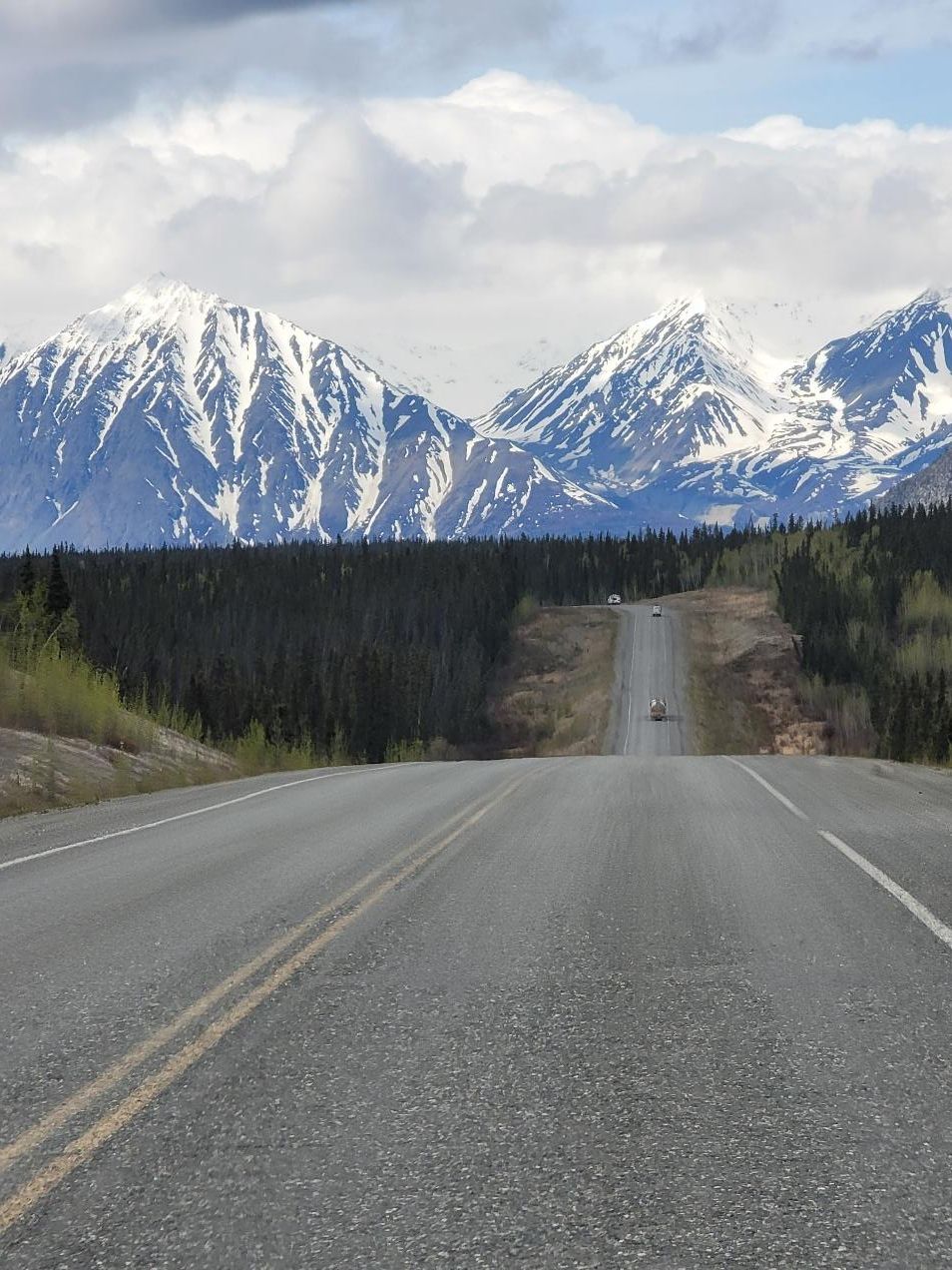
We stopped at the
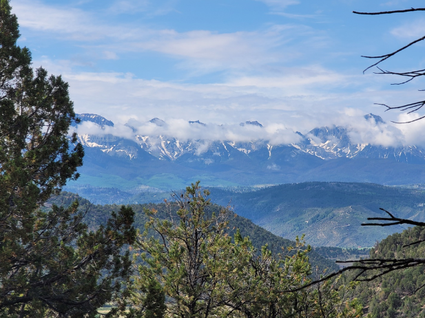
Kluane National Park Visitor Center to stretch our legs, eat lunch, and take in the Kluane mountain range views from the patio.
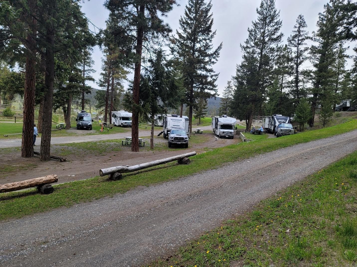
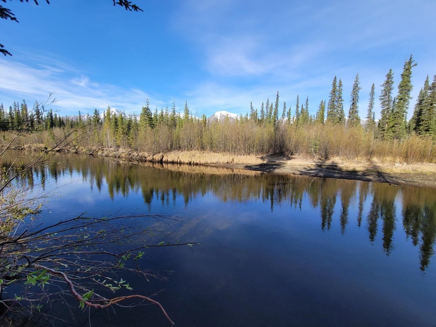
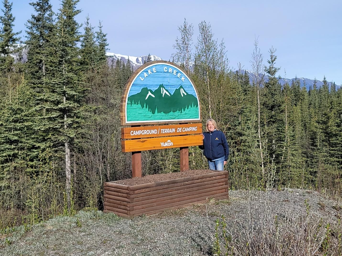
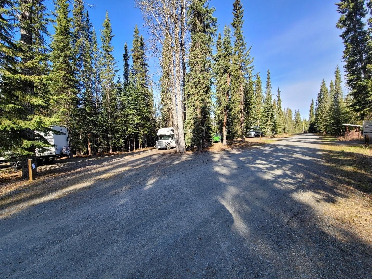
That night we stayed at
Lake Creek Campground, a Yukon territorial park with 27 sites, 13 of which are pull-throughs. Located at the base of the Kluane Mountains in a spruce, willow, and alder forest, some sites sit along the Koidern River (Thäw Kųghär Nji). There are no reservable sites, but we had no trouble finding space mid-afternoon.
Day 8 — Back in the USA and On to Tok, Alaska
Miles driven: 160 miles
After the long day prior, we appreciated the shorter drive and had extra time built in for the border crossing into Alaska.
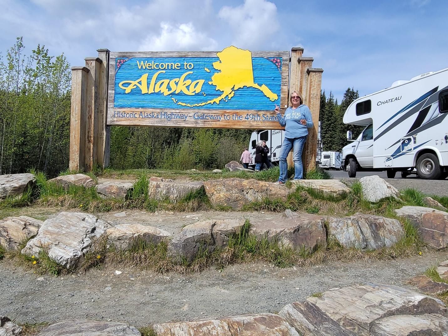
We stopped at the
Welcome to Alaska sign for group photos and a quick stretch. Most crossings were routine, though one caravan member was pulled into secondary inspection after mistakenly entering the commercial vehicle lane. The search focused mostly on food, with 18 raw eggs confiscated.
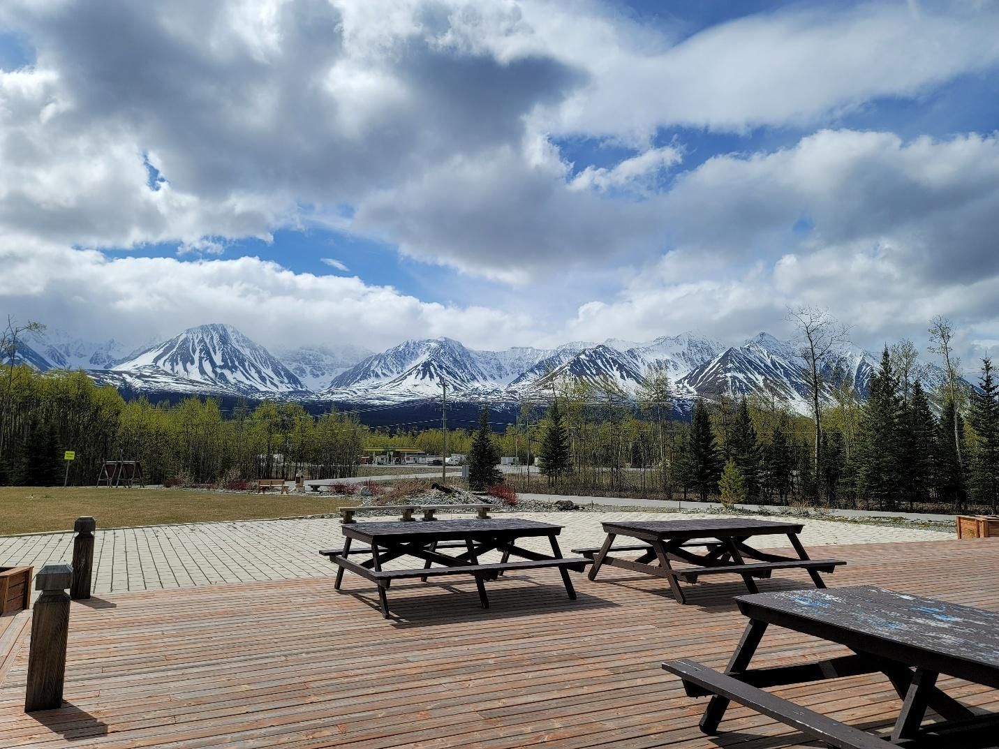
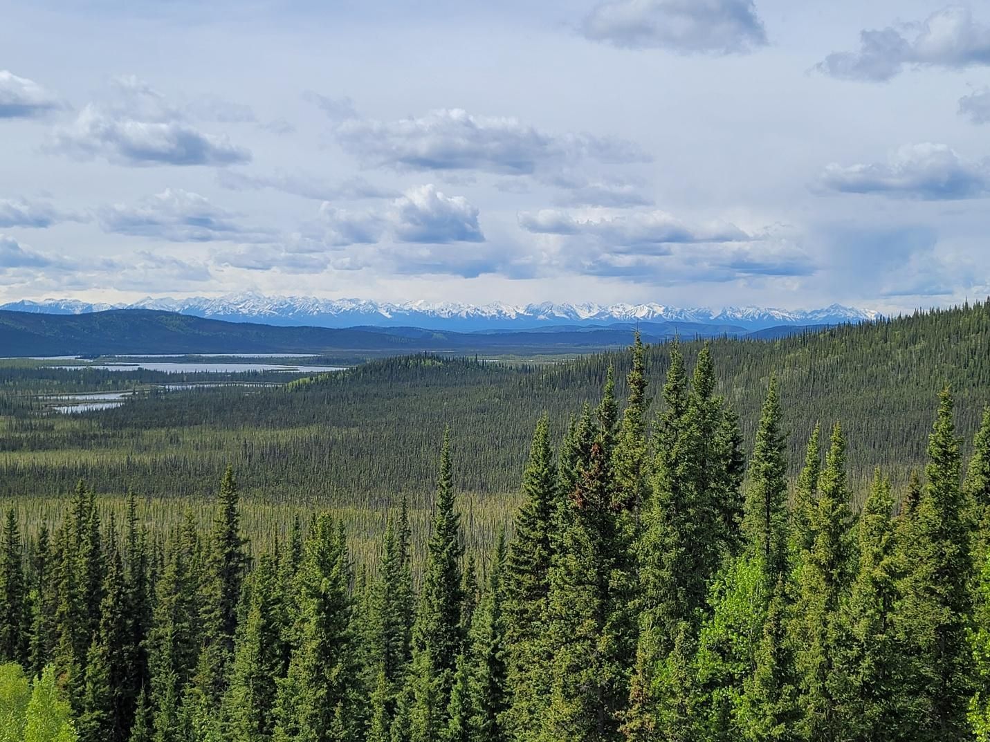
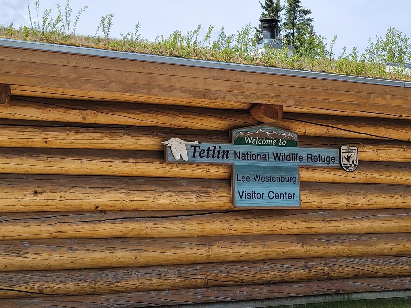
One of our rest stops included the Tetlin National Wildlife Refuge Visitor Center. It was a great place to stop for lunch and take in the view of the mountain range from the outdoor deck.
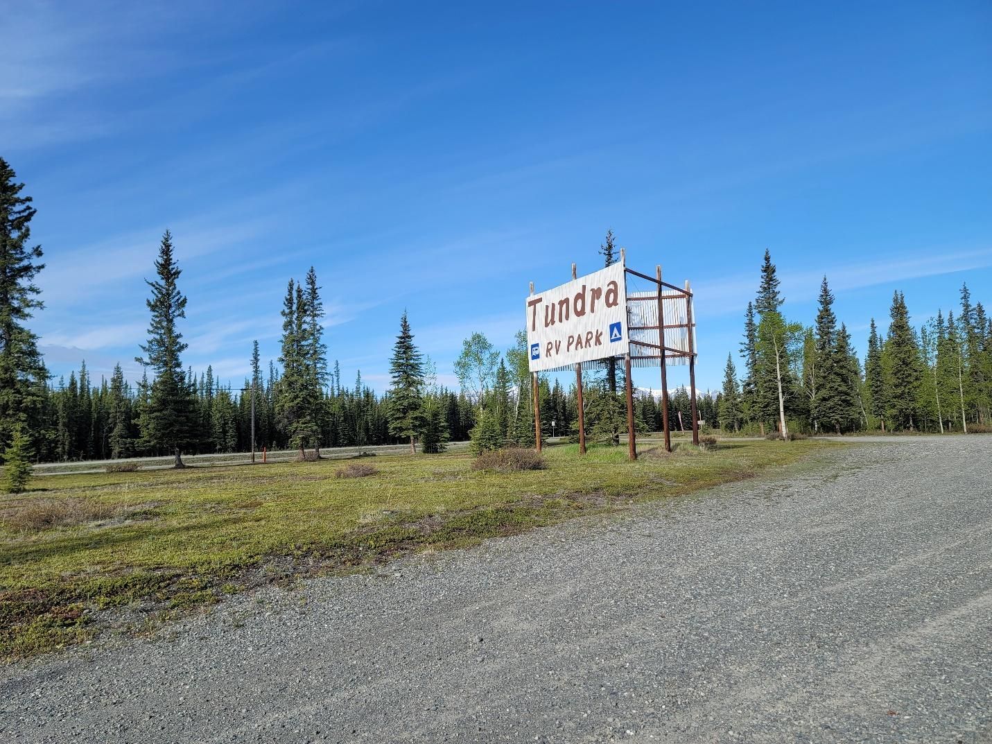
That evening we stayed at
Tundra RV Park & Bar in Tok, Alaska — a full-service park with big-rig-friendly pull-through sites, laundry, a vehicle wash, and a bar. After settling in, we gathered for cocktails and a debrief of the day’s events.
Day 9 — Tok to Palmer, Alaska
Final caravan destination: Matanuska River Park
Miles driven: 277 miles
Although the official end of the Alaska Highway is Delta Junction, our route took us down the Tok Cutoff, onto the Richardson Highway, and finally along the Glenn Highway.
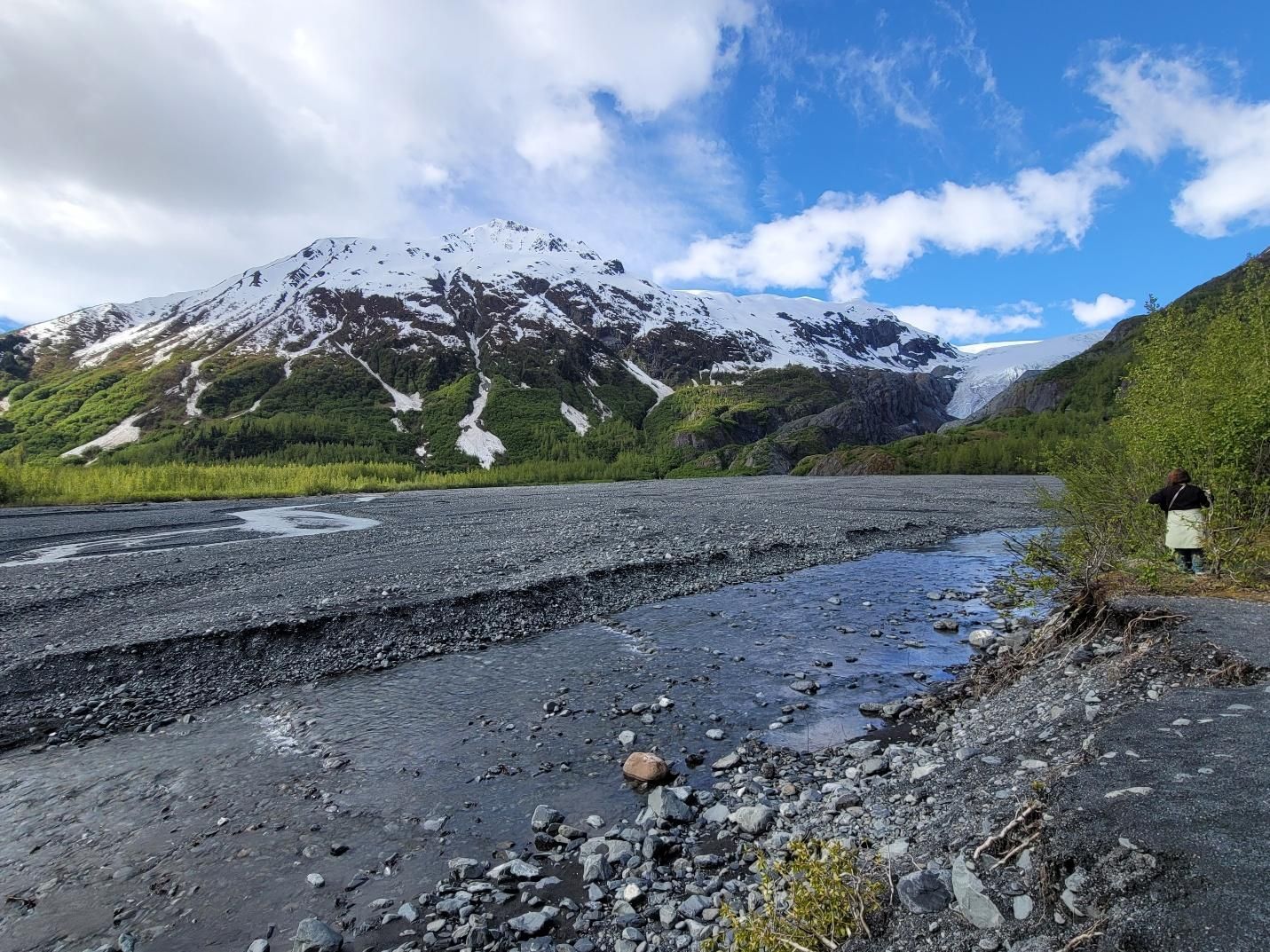
We passed through Mentasta Lake, Slana, Chistochina, Gakona, Gulkana, Glennallen, Mendeltna, and Nelchina, stopping at
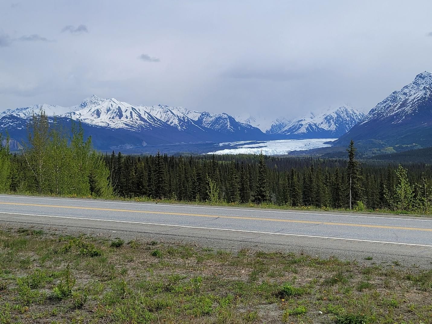
Eureka Roadhouse to refuel and take in the amazing view before continuing to the Glacier View pullout. The view of the
Matanuska Glacier
is one of those moments that stops you in your tracks.
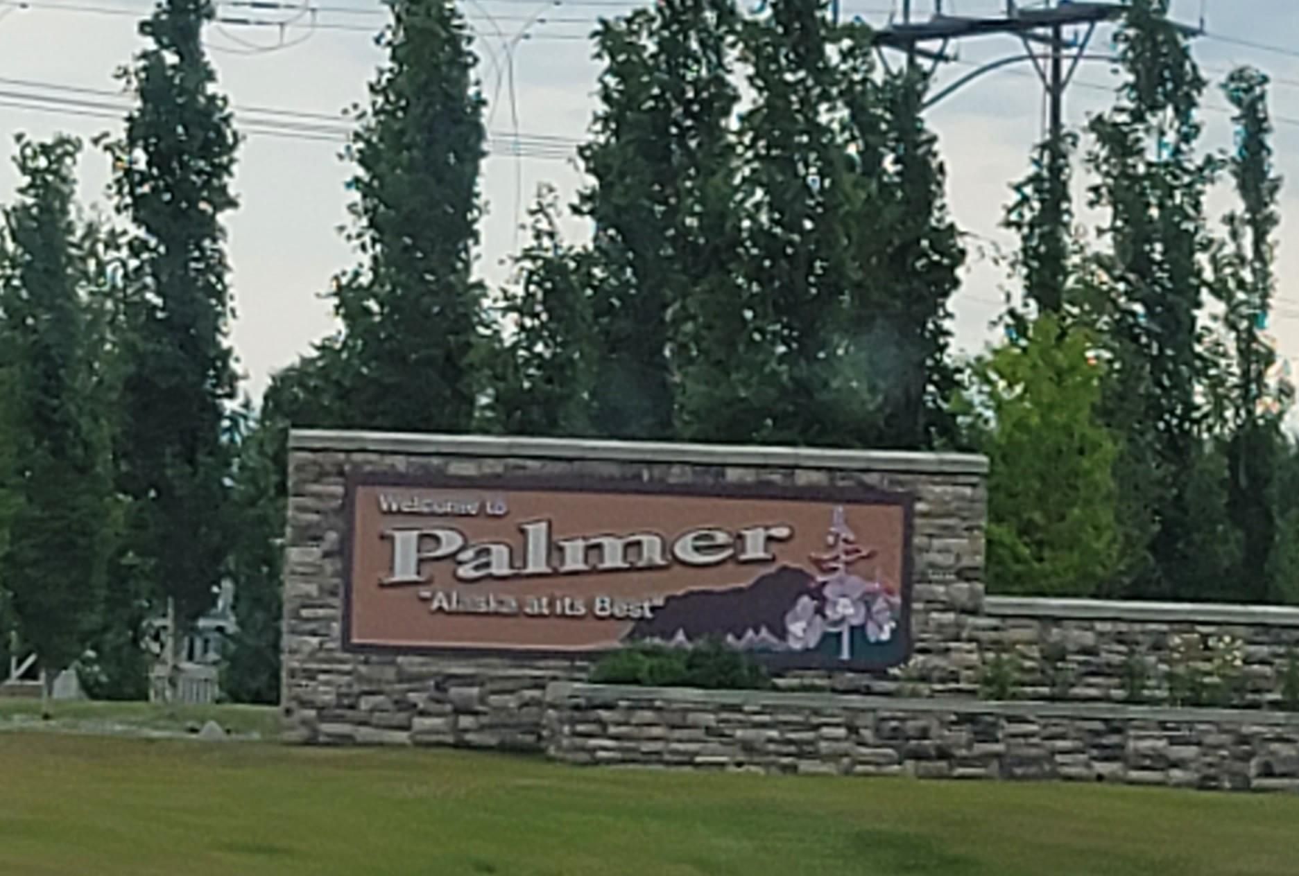
From there, we continued through Chickaloon and into
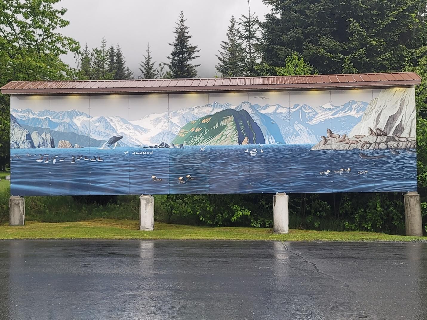
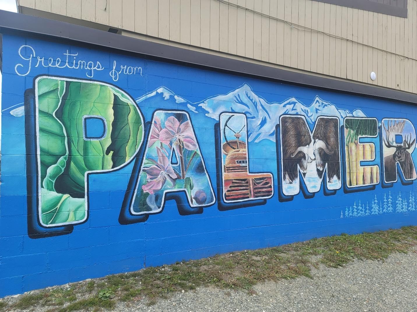
Palmer Alaska, arriving at
Matanuska River Park, located at mile 17 of the Old Glenn Highway. The park offers 87 tent and RV sites (including caravan sites), flush toilets, hot showers, a dump station, picnic areas, pavilions, trails, river access, and more. Reservations aren’t required but are recommended, especially during peak season. The park is conveniently located to grocery stores and all that Palmer Alaska has to offer.
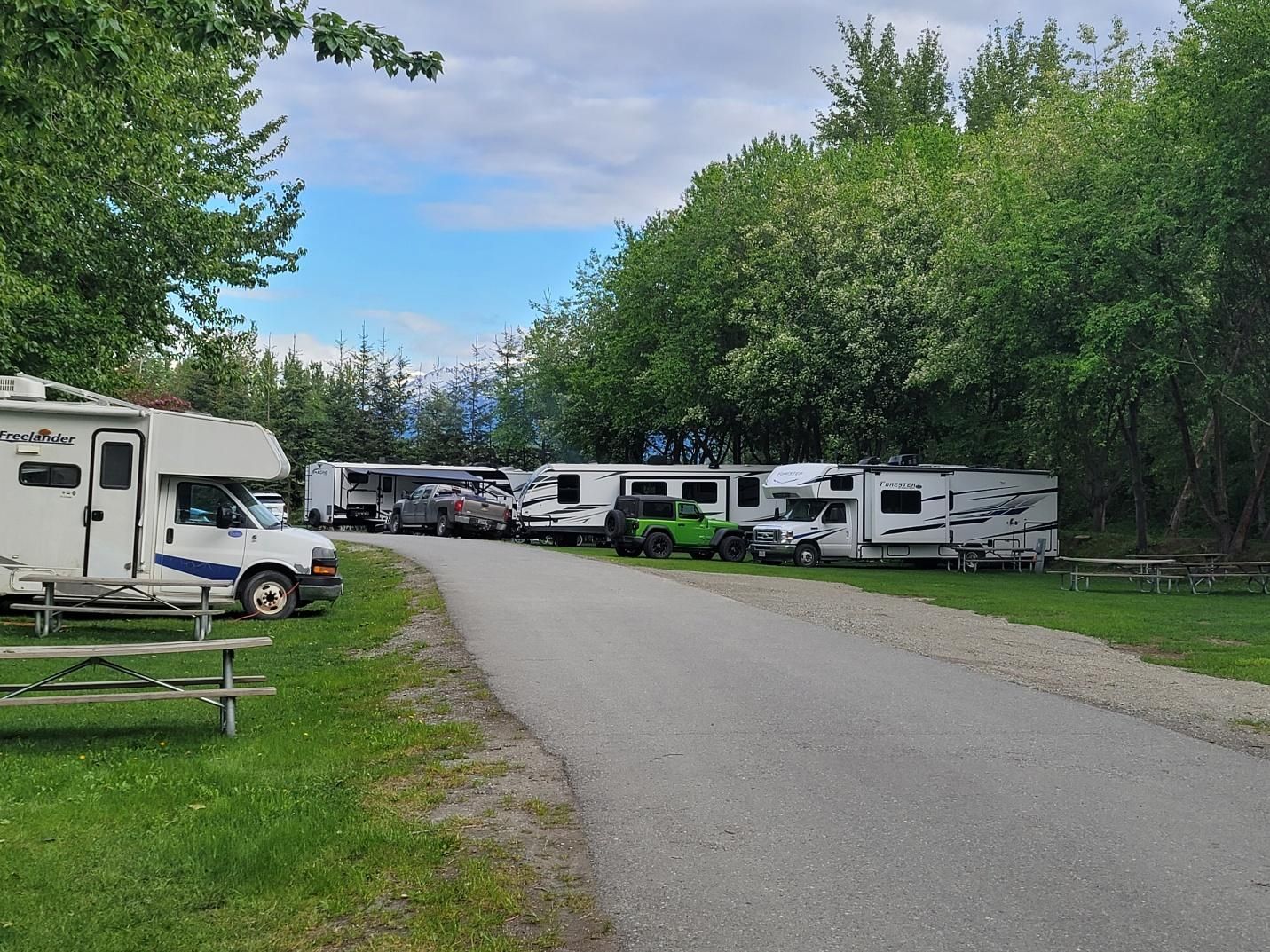
I extended my stay here for five days to decompress after nine full days on the road. You can read more about that stay in a separate post.
Cassiar Highway vs Alaska Highway (AlCan): A Quick Comparison
If you’re deciding between the Cassiar Highway and the Alaska Highway, here’s the simplest way I can describe it based on actually driving the Cassiar northbound.
| Cassiar Highway (Highway 37) | Alaska Highway (AlCan) |
|---|---|
| More remote and quieter | Busier and more developed |
| Fewer towns and services | More towns, fuel stops, and services |
| Heavier emphasis on fuel planning | Easier for first-time northern drivers |
| Big scenery with fewer people | Still scenic, but more traffic and RV congestion |
| Feels more like an expedition than a road trip |
Many travelers choose to take one route north and the other south. I chose the Cassiar going north and took the Alaska Highway returning to the lower 48 in August.
Frequently Asked Questions
Is the Cassiar Highway safe for RVs and motorhomes?
Yes. The Cassiar Highway (Highway 37) is fully paved and regularly traveled by RVs, including large motorhomes and trailers. Road conditions vary year to year and even day to day, but during my trip the road was in good shape overall. Expect some rough patches, frost heaves, and construction zones — nothing unusual for northern highways. Driving slower than you would in the Lower 48 makes a big difference.
Do I need four-wheel drive to drive the Cassiar Highway?
No. Four-wheel drive is not required. I completed the route in a Class C motorhome without issue. Good tires, a full-size spare, and paying attention to conditions matter far more than drivetrain.
How far apart are fuel stops on the Cassiar Highway?
Fuel stops are farther apart than most drivers are used to, which is where much of the anxiety comes from. Fuel is available at key points such as Meziadin Junction, Bell II, and near Dease Lake. The simple rule that worked for us: top off whenever fuel is available, even if your tank isn’t low yet.
Is the Cassiar Highway very remote?
Yes — and that’s a big part of its appeal. Cell service is limited to nonexistent in many stretches, and services are sparse. This route is best for travelers who are comfortable being off-grid for long distances and hours at a time.
Should I take the Cassiar Highway or the Alaska Highway?
They offer very different experiences. The Cassiar is quieter, more remote, and feels wilder. The Alaska Highway has more towns, services, and traffic. I chose the Cassiar for my northbound trip and was very glad I did.
Is The Milepost really necessary?
In my opinion, yes. Even though it initially overwhelmed me, once I learned how to use it, The Milepost became one of the most valuable resources on the trip — especially on the Cassiar where distances between services matter.
Are there enough campgrounds along the Cassiar Highway?
Yes, but expectations matter. Campgrounds tend to be small proprietor-owned RV parks, BC provincial parks, and simple roadside stops rather than large commercial resorts. Planning nightly stops ahead of time helps reduce stress.
What time of year is best for driving the Cassiar Highway?
Late May through early September is the typical travel window. I drove north in late May and appreciated lighter traffic, available campsites, and cooler temperatures. Early and late season travel increases the chance of cold nights or snow.
What kind of wildlife should I expect?
Wildlife sightings are common, including bears and moose. Drive alertly, especially early in the morning and in the evening, and never assume animals will move quickly or predictably.
Would I drive the Cassiar Highway again?
Absolutely. It requires patience, flexibility, and a willingness to slow down, but the scenery, quiet, and overall experience make it one of the most memorable drives of my RV travels.
Share My Latest Adventure
Interested In Supporting Me On My Travel Journey?